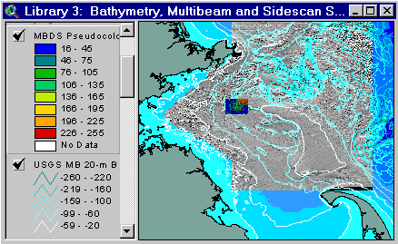
Sample from the ArcView window for Library 3
Library 3: Bathymetry, Multibeam, and Sidescan Sonar Data
Return to TABLE OF CONTENTS
Continue to LIBRARY 4
| To view all the coverages described in this Library, open the view titled Library 3 while running the ArcView project (mbay_30.apr or mbay_31.apr) in the mbaygis directory of this CD-ROM. To view summary metadata (file names, descriptions, provider, references) see the table below. To view complete metadata, go to directory "9_biblio" on this CD-ROM and open the file metadata.mdb using Microsoft Access or the file Gismeta.htm using your browser. |
Sample from the ArcView window for Library 3 |
Sea floor topography is a fundamental underpinning for research and management in the coastal ocean. Four bathymetric data sets are included on this CD-ROM; (1) A compilation of all available data from the Gulf of Maine gridded at 15 arc seconds (approximately 0. 5 km) and 30 arc seconds, including land topography and selected contours (from Signell and others, 1999); (2) 5 m and 20 m contours based on a map of the Massachusetts Bay Region published by Valentine, Schmuck and others (1995); (3) Bathymetry and shaded relief images from multibeam echosounder surveys of the Stellwagen Bank National Marine Sanctuary (Valentine, Baker, Unger, and Polloni, 1998; Valentine, Baker, Unger, and Polloni, 1999), the Massachusetts Bay Disposal Site (Valentine, Baker, Unger, Evans, and Polloni, 1998), and western Massachusetts Bay (Butman and others, in prep.); and (4) Bathymetry from surveys of the Industrial Waste Site in 1988 (2 m contours) and 1993 (SAIC).
Gulf of Maine Bathymetric Grids and Contours
Signell and others (1999) collected data from available sources on the World Wide Web and from CD-ROM products. The data included digital sounding data, digitized contour line data and previously gridded products from a variety of sources. Generic Mapping Tools (GMT) was used to produce 15 and 30 second grids that were exported as XYZ ASCII files and read into ARC/INFO to produce grid files.
These data are available in ARC/INFO grid format (for use in ArcView with Spatial Analyst) as well as TIFF format. Both sets of tifs and grids are provided in Geographic coordinate system (Gom15grd, Gom30grd, Gom15tfg.tif, Gom30tfg.tif) and Mercator projection (Gom15grm, Gom30grm, Gom15tfm.tif, Gom30tfm.tif). In order to discern the detail in the bathymetric grids, it is necessary to load the legend "gom_grd.avl" for each of the 4 grids.
The Mercator parameters are as follows: datum = NAD83, spheroid = GRS80, central meridian = -70.31667, latitude of true scale = 41.65.
Contour lines were created in ARC/INFO from gom15grd. A finer contour interval was used in shallower depths. (Contoured at -4000, -3000, -2000, -1000, -500, -400, -300, -280, -260, -240, -220, -200, -180, -160, -140, -120, -100, -90, -80, -70, -60, -50, -40, -30, -20, -15, -10, -5 meters).
Multibeam Surveys – bathymetry and acoustic backscatter
A multibeam echosounder survey of the Stellwagen Bank National Marine Sanctuary and western Massachusetts Bay was conducted by the U.S. Geological Survey (USGS) in cooperation with the National Oceanic and Atmospheric Administration, the University of New Brunswick, and the Canadian Hydrographic Service (Valentine and Butman, 1998; Valentine, Baker, Unger, and Polloni, 1998). The images and data from these surveys provide a detailed description of the bathymetry and surficial geology. They are utilized in ongoing USGS studies of the long-term fate of sediments and contaminants, biological habitats, and contribute to the USGS effort to map the continental margin of the U.S. Exclusive Economic Zone (Gardner and others, 1998).
For publication purposes, the region has been divided into 21 Quadrangles (see USGS quad coverage). For each quadrangle, paper maps at a scale of 1:25,000 showing bathymetry and shaded relief will be published. The bathymetry for quadrangles 1-18 are published in paper form (Valentine, Baker and others, 1997a-i; Valentine, Unger and others, 1997a-i) and in digital form (Valentine, Baker, Unger, and Polloni, 1998). The shaded relief maps are published in paper (Valentine, Unger, and Baker, 1999) and in digital form (Valentine, Unger, Baker, and Polloni, 1999). Interpretive maps of Quadrangles 1-18, showing the sea floor environments, are in preparation. Publication of the multibeam data for Quadrangles 19-21 is in preparation (Butman and others, in prep.).
Maps of the Massachusetts Bay Disposal Site, also based on multibeam surveys, have been published at a scale of 1:10,000, and 1:12,500 (Valentine, Danforth and others, 1996). The data is published digitally (Valentine, Baker, Unger, Evans, and Polloni, 1998). These data have been converted to ARC/INFO grids and are included on this CD-ROM.
Maps of topography and surface characteristics based on multibeam surveys on this CD-ROM
The multibeam sea floor mapping systems data are provided at two horizontal resolutions on this CD-ROM. The maps of western Massachusetts Bay (USGS Quadrangles 19-21) were gridded at 6 m pixel size. The contours in the Stellwagen Bank National Marine Sanctuary (Quadrangles 1-18) were produced from bathymetry gridded at 10 m resolution.
Four types of maps, each providing a different view of the sea floor, can be generated from the multibeam echosounder data.
Bathymetric contour maps: The gridded multibeam bathymetric data were contoured at five meter intervals. In this compilation, the bathymetry from the Stellwagen Bank NMS (Quadrangles 1-18) are presented as one coverage, and the bathymetric contours from western Massachusetts Bay (Quadrangles 19-21) are presented as one coverage.
Shaded relief maps: These images were created by vertically exaggerating the bathymetry (in this case 5 times) and artificially illuminating (in this case by a source shining from the northwest) the relief. The shadows in the image show the small scale variability of the bathymetry (relief of a few meters) that would be difficult to show in a traditional contour map. The roughness provided by this display illustrates the various sedimentary regimes in Massachusetts Bay. The shaded relief is presented in a northern part (Quadrangles 10-18), a southern part (Quadrangles 1-9), and a western Massachusetts Bay part (Quadrangles 19-21).
Backscatter intensity: The intensity of the acoustic return from the sea floor is a measure of the properties of the surficial sediments and of the bottom roughness. Generally, a strong return (usually shown as light shades) is associated with rock or coarse-grained sediment, while a weak return (shown as dark shades) with fine-grained sediments. Direct observations, using bottom photography or video, are needed to verify interpretations of the backscatter intensity. Because of space limitations on this CD-ROM, backscatter intensity images are presented only for the Massachusetts Bay Disposal Site.
Pseudo-colored shaded relief maps: The intensity of the acoustic return from the sea floor is a measure of the properties of the surficial sediments and of the bottom roughness (a strong return indicating coarse grained sediment or rock, a weak return indicating fine grained sediments). The acoustic backscatter strength can be combined with the shaded relief image to visualize the distribution of sediment type in relation to the topography. Within each backscatter color, the intensity varies from dark to light depending on the sun illumination. Psuedo-colored shaded relief images are included for western Massachusetts Bay (Quadrangles 19-21).
Low (Mud)  High (Gravel)
Backscatter Intensity
Coloring the grids:
The grids should be displayed in the project files with the intended colors. However, if the user adds these themes to new views, the following instructions will be helpful.
Colormap files (.clr) allow the grids to be displayed with the correct color scheme when the grid theme is added as "image data". This happens automatically as long as the .clr is in the same directory as the grid and they have the same name. Since colormap files do not have a "nodata" designation, the cells with no values are automatically colored black. The user may change this by pressing the "colormap..." button in the Image Legend Editor, scrolling to the bottom of the list to find "NODATA", and changing it to white or transparent.
If the Spatial Analyst extension is loaded, a third data source type called "grid data" is available in the "add theme" dialog box. If the grids are added as grid data, ArcView will automatically choose its own colors. The user can load the correct legend (.avl) from the legend editor. The backscatter and shaded relief grids use the same legend. To color the pseudocolor shaded relief maps correctly, 2 grids must be opened in the view; the pseudocolor grid and the shaded relief grid for the same area (i.e.: wmbpsdcm and wmbshd_m). Load the appropiate legend to the shaded relief, and then load the legend to the pseudocolor grid. While still in the legend editor press the "advanced" button, choose the shaded relief as the brightness theme (wmbshd_m), and press OK and Apply.
|
Grid(s) |
Associated Legend |
|
dump_psd |
dump_psd.avl |
|
dumppsdm |
dumppsdm.avl |
|
dump_ss, dumpssm |
backsc.avl |
|
dump_sun, dumpsunm |
backsc.avl |
|
wmbshd_g, wmbshd_m |
wmbshade.avl |
|
wmbpsd_g |
wmbpsd_g.avl |
|
wmbpsd_m |
wmbpsd_m.avl |
|
gom15grd, gom15grm |
gom_grd.avl |
|
gom30grd, gom30grm |
gom_grd.avl |
Sidescan Sonar Surveys
Bothner and others (1992) carried out detailed sidescan sonar mapping of the region surrounding the MWRA ocean outfall, providing a geological framework for selecting sites for long-term monitoring.
Coverages provided in Library 3: (Summary metadata for files in the Library 3 view are listed alphabetically in the table below. For complete metadata, go to directory "9_biblio" on this CD-ROM and open the file metadata.mdb using Microsoft Access or the file
Gismeta.htm using your browser.)
| File Name | Layer Content | Published reference | E-mail of Contact Person | Agency/Organization |
|---|---|---|---|---|
| 1985ss.shp | Sidescan tracks from Mass Bay Disposal Site Survey | seidelc@mtg.saic.com | SAIC | |
| bathy.shp | 5-meter bathymetric contour lines | USGS | ||
| bathy20.shp | 20-meter contour lines | Stellwagen Bank Information System web site | seidelc@mtg.saic.com | SAIC/USGS |
| bathy5mb.shp | 5-meter bathymetric contour lines for Western Mass Bay (Quads 19-21) | Butman, B., W. W. Danforth and L. Hayes, Sea Floor Topography and Backscatter of Quadrangles 19-21, Western Massachusetts Bay, Off Boston, Massachusetts, USGS Open-File Report (in prep.) | bbutman@usgs.gov, lhayes@usgs.gov | USGS |
| bathy5sb.shp | 5-meter bathymetric contour lines for Stellwagen Bank (Quads 1-18) | Valentine, P., J. Baker, T. Unger, C. Polloni, 1998, Sea Floor Topographic Map and Perspective-View Imagery of Quadrangles 1-18, Stellwagen Bank National Marine Sanctuary off Boston, Massachusetts, USGS Open-File Report 98-138. | pvalentine@usgs.gov; lhayes@usgs.gov | USGS |
| colorbar.tif | Tif image showing color scale for USGS pseudocolor images | Valentine, Baker, Unger, Evans, and Polloni, 1998, U.S. Geological Survey Open-File Report 98-344. 1 CD-ROM. Sea Floor Topographic, Backscatter, and Interpretive Maps and Bottom Photos of the Massachusetts Bay Disposal Site region off Boston, MA. | pvalentine@usgs.gov, lhayes@usgs.gov | USGS |
| dump_psd | Pseudocolor/Shaded Relief image (ARC/INFO grid) of MassBay disposal site (see description) | Valentine, Baker, Unger, Evans, and Polloni, 1998, U.S. Geological Survey Open-File Report 98-344. 1 CD-ROM. Sea Floor Topographic, Backscatter, and Interpretive Maps and Bottom Photos of the Massachusetts Bay Disposal Site region off Boston, MA. | pvalentine@usgs.gov, lhayes@usgs.gov | USGS |
| dump_ss | Backscatter image (ARC/INFO grid) of MassBay disposal site | Valentine, Baker, Unger, Evans, and Polloni, 1998, U.S. Geological Survey Open-File Report 98-344. 1 CD-ROM. Sea Floor Topographic, Backscatter, and Interpretive Maps and Bottom Photos of the Massachusetts Bay Disposal Site region off Boston, MA. | pvalentine@usgs.gov, lhayes@usgs.gov | USGS |
| dump_sun | Shaded Relief image (ARC/INFO grid) of MassBay disposal site | Valentine, Baker, Unger, Evans, and Polloni, 1998, U.S. Geological Survey Open-File Report 98-344. 1 CD-ROM. Sea Floor Topographic, Backscatter, and Interpretive Maps and Bottom Photos of the Massachusetts Bay Disposal Site region off Boston, MA. | pvalentine@usgs.gov, lhayes@usgs.gov | USGS |
| dumppsdm | Pseudocolor/Shaded Relief image (ARC/INFO grid) of MassBay disposal site (see description) | Valentine, Baker, Unger, Evans, and Polloni, 1998, U.S. Geological Survey Open-File Report 98-344. 1 CD-ROM. Sea Floor Topographic, Backscatter, and Interpretive Maps and Bottom Photos of the Massachusetts Bay Disposal Site region off Boston, MA. | pvalentine@usgs.gov, lhayes@usgs.gov | USGS |
| dumpssm | Backscatter image (ARC/INFO grid) of MassBay disposal site | Valentine, Baker, Unger, Evans, and Polloni, 1998, U.S. Geological Survey Open-File Report 98-344. 1 CD-ROM. Sea Floor Topographic, Backscatter, and Interpretive Maps and Bottom Photos of the Massachusetts Bay Disposal Site region off Boston, MA. | pvalentine@usgs.gov, lhayes@usgs.gov | USGS |
| dumpsunm | Shaded Relief image (ARC/INFO grid) of MassBay disposal site | Valentine, Baker, Unger, Evans, and Polloni, 1998, U.S. Geological Survey Open-File Report 98-344. 1 CD-ROM. Sea Floor Topographic, Backscatter, and Interpretive Maps and Bottom Photos of the Massachusetts Bay Disposal Site region off Boston, MA. | pvalentine@usgs.gov, lhayes@usgs.gov | USGS |
| Epass96.shp | Location of sidescan track lines from 1996 | wwwnurc@uconnvm.uconn.edu | NOAA/NURC | |
| fads88.shp | Contour lines from 1988 Survey | SAIC Contribution 79: Valente and Walton, April 1989, Seasonal Monitoring Cruise at the Foul Area Disposal Site, November 1988 - January 1989. | seidelc@mtg.saic.com | SAIC |
| Fbld_geo.tif | 1997 Side Scan Mosaic of the Former BLD | matthias@coscan.com | Polaris Imaging | |
| gom15ctr.shp | Contour lines for Gulf of Maine (see description for values contoured). | Roworth, E. and Signell, R., 1999, Construction of digital bathymetry for the Gulf of Maine. U.S. Geological Survey Open-File Report 98-801. 1 CD-ROM. | rsignell@usgs.gov, lhayes@usgs.gov | USGS |
| gom15grd | 15 second grid of Gulf of Maine bathymetry (Geographic) | Roworth, E. and Signell, R., 1999, Construction of digital bathymetry for the Gulf of Maine. U.S. Geological Survey Open-File Report 98-801. 1 CD-ROM. | rsignell@usgs.gov, lhayes@usgs.gov | USGS |
| gom15grm | 15 second grid of Gulf of Maine bathymetry (Mercator) | Roworth, E. and Signell, R., 1999, Construction of digital bathymetry for the Gulf of Maine. U.S. Geological Survey Open-File Report 98-801. 1 CD-ROM. | rsignell@usgs.gov, lhayes@usgs.gov | USGS |
| gom15tfg.tif | 15 second grid of Gulf of Maine bathymetry, converted to tif (Geographic) | Roworth, E. and Signell, R., 1999, Construction of digital bathymetry for the Gulf of Maine. U.S. Geological Survey Open-File Report 98-801. 1 CD-ROM. | rsignell@usgs.gov, lhayes@usgs.gov | USGS |
| gom15tfm.tif | 15 second grid of Gulf of Maine bathymetry, converted to tif (Mercator) | Roworth, E. and Signell, R., 1999, Construction of digital bathymetry for the Gulf of Maine. U.S. Geological Survey Open-File Report 98-801. 1 CD-ROM. | rsignell@usgs.gov, lhayes@usgs.gov | USGS |
| gom30grd | 30 second grid of Gulf of Maine bathymetry (Geographic) | Roworth, E. and Signell, R., 1999, Construction of digital bathymetry for the Gulf of Maine. U.S. Geological Survey Open-File Report 98-801. 1 CD-ROM. | rsignell@usgs.gov, lhayes@usgs.gov | USGS |
| gom30grm | 30 second grid of Gulf of Maine bathymetry (Mercator) | Roworth, E. and Signell, R., 1999, Construction of digital bathymetry for the Gulf of Maine. U.S. Geological Survey Open-File Report 98-801. 1 CD-ROM. | rsignell@usgs.gov, lhayes@usgs.gov | USGS |
| gom30tfg.tif | 30 second grid of Gulf of Maine bathymetry, converted to tif (Geographic) | Roworth, E. and Signell, R., 1999, Construction of digital bathymetry for the Gulf of Maine. U.S. Geological Survey Open-File Report 98-801. 1 CD-ROM. | rsignell@usgs.gov, lhayes@usgs.gov | USGS |
| gom30tfm.tif | 30 second grid of Gulf of Maine bathymetry, converted to tif (Mercator) | Roworth, E. and Signell, R., 1999, Construction of digital bathymetry for the Gulf of Maine. U.S. Geological Survey Open-File Report 98-801. 1 CD-ROM. | rsignell@usgs.gov, lhayes@usgs.gov | USGS |
| mbds93p.shp | Polygon bathymetry from 1993 Survey | SAIC Report 317: E. DeAngelo & P. Murray, Baseline Survey of the Massachusetts Bay Disposal Site: Final Designation, 14 September 1993. | seidelc@mtg.saic.com | SAIC |
| mbds93ss.shp | Sidescan images from 1993 MBDS survey | Saic Report 317: E. DeAngelo & P. Murray, Baseline Survey of the Massachusetts Bay Disposal Site: Final Designation, 14 September 1993. | seidelc@mtg.saic.com | SAIC |
| outf_ss.tif | Digital mosaic of sidescan-sonar images of the region surrounding the MWRA outfall | Bothner, et al., 1992, A Geologic Map of the Sea Floor in Western Massachusetts Bay, Constructed from Digital Sidescan-Sonar Images, Photography, and Sediment Samples, USGS DDS-3 | mbothner@usgs.gov | USGS |
| Sbshd_ng.tif | Shaded Relief for Northern Stellwagen Bank, Geographic coordinates | Valentine, P., T. Unger, J. Baker, and C. Polloni, 1999, Sun-illuminated sea floor topographic maps and perspective-view imagery of Quadrangles 1-18, Stellwagen Bank National Marine Sanctuary off Boston, MA, U.S. Geological Survey Open-File Report 99-363. | pvalentine@usgs.gov | USGS |
| Sbshd_nm.tif | Shaded Relief for Northern Stellwagen Bank, Mercator projection | Valentine, P., T. Unger, J. Baker, and C. Polloni, 1999, Sun-illuminated sea floor topographic maps and perspective-view imagery of Quadrangles 1-18, Stellwagen Bank National Marine Sanctuary off Boston, MA, U.S. Geological Survey Open-File Report 99-363. | pvalentine@usgs.gov | USGS |
| Sbshd_sg.tif | Shaded Relief for Southern Stellwagen Bank, Geographic coordinates | Valentine, P., T. Unger, J. Baker, and C. Polloni, 1999, Sun-illuminated sea floor topographic maps and perspective-view imagery of Quadrangles 1-18, Stellwagen Bank National Marine Sanctuary off Boston, MA, U.S. Geological Survey Open-File Report 99-363. | pvalentine@usgs.gov | USGS |
| Sbshd_sm.tif | Shaded Relief for Southern Stellwagen Bank, Mercator projection | Valentine, P., T. Unger, J. Baker, and C. Polloni, 1999, Sun-illuminated sea floor topographic maps and perspective-view imagery of Quadrangles 1-18, Stellwagen Bank National Marine Sanctuary off Boston, MA, U.S. Geological Survey Open-File Report 99-363. | pvalentine@usgs.gov | USGS |
| Sstarget.shp | Target locations from 1997 Side Scan Mosaic | matthias@coscan.com | Polaris Imaging | |
| stell_dd | Gridded bathymetry | cpolloni@usgs.gov, pvalentine@usgs.gov | USGS | |
| wmbpsd_g | Pseudocolor image (ARC/INFO grid) Western Massachusetts Bay in Geographic coordinates (see description) | Butman, B., W. W. Danforth and L. Hayes, Sea Floor Topography and Backscatter of Quadrangles 19-21, Western Massachusetts Bay, Off Boston, Massachusetts, USGS Open-File Report (in prep.) | bbutman@usgs.gov, lhayes@usgs.gov | USGS |
| wmbpsd_m | Pseudocolor image (ARC/INFO grid) Western Massachusetts Bay in Mercator projection (see description) | Butman, B., W. W. Danforth and L. Hayes, Sea Floor Topography and Backscatter of Quadrangles 19-21, Western Massachusetts Bay, Off Boston, Massachusetts, USGS Open-File Report (in prep.) | bbutman@usgs.gov, lhayes@usgs.gov | USGS |
| wmbshd_g | Shaded relief map of Western Massachusetts Bay in Geographic coordinates | Butman, B., W. W. Danforth and L. Hayes, Sea Floor Topography and Backscatter of Quadrangles 19-21, Western Massachusetts Bay, Off Boston, Massachusetts, USGS Open-File Report (in prep.) | bbutman@usgs.gov, lhayes@usgs.gov | USGS |
| wmbshd_m | Shaded relief map of Western Massachusetts Bay in Mercator projection | Butman, B., W. W. Danforth and L. Hayes, Sea Floor Topography and Backscatter of Quadrangles 19-21, Western Massachusetts Bay, Off Boston, Massachusetts, USGS Open-File Report (in prep.) | bbutman@usgs.gov, lhayes@usgs.gov | USGS |
Return to TABLE OF CONTENTS
Continue to LIBRARY 4
[an error occurred while processing this directive]