
![]()
![]()
U.S. DEPARTMENT OF THE INTERIOR
U.S. GEOLOGICAL SURVEY
|
By
|
Open-File Report 99-50-C
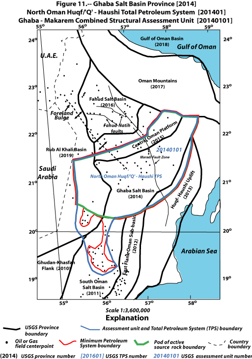
| Figure 11. Map showing Ghaba Salt Basin Province (2014), North Oman Huqf/`Q' Haushi(!) Total Petroleum System (201401), and Ghaba-Makarem Combined Structural Assessment Unit (20140101). Oil and gas field centerpoints (Petro-consultants, 1996) and boundaries for pod of active source rock and minimum petroleum system are also shown. Scale = 1:3,600,000. |
 |
| <<PREVIOUS Figure | Return to List of Figures |