
![]()
![]()
U.S. DEPARTMENT OF THE INTERIOR
U.S. GEOLOGICAL SURVEY
|
By
|
Open-File Report 99-50-C
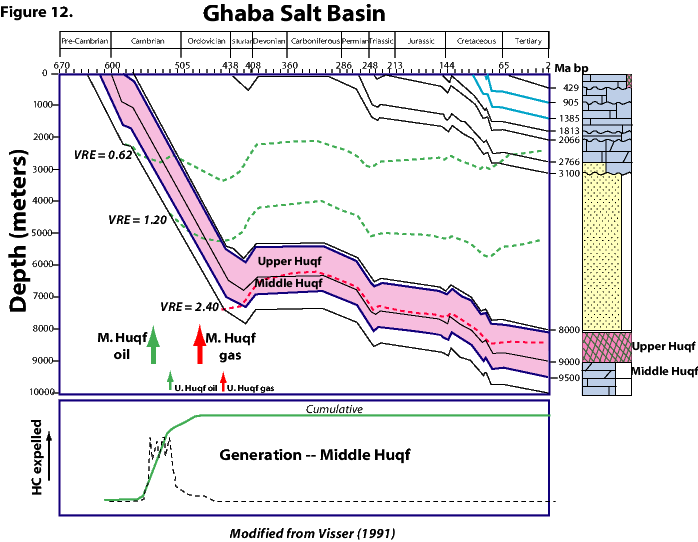
| Figure 12. Burial-history diagram, vitrinite reflectance equivalant (VRE), and stages of hydrocarbon (HC) generation for Huqf source rocks from unidentified well in vicinity of Saih Rawl field, Ghaba Salt Basin Province, Oman. Modified from Visser (1991). |
 |
| <<PREVIOUS Figure | Return to List of Figures |