
![]()
![]()
U.S. DEPARTMENT OF THE INTERIOR
U.S. GEOLOGICAL SURVEY
|
By
|
Open-File Report 99-50-C
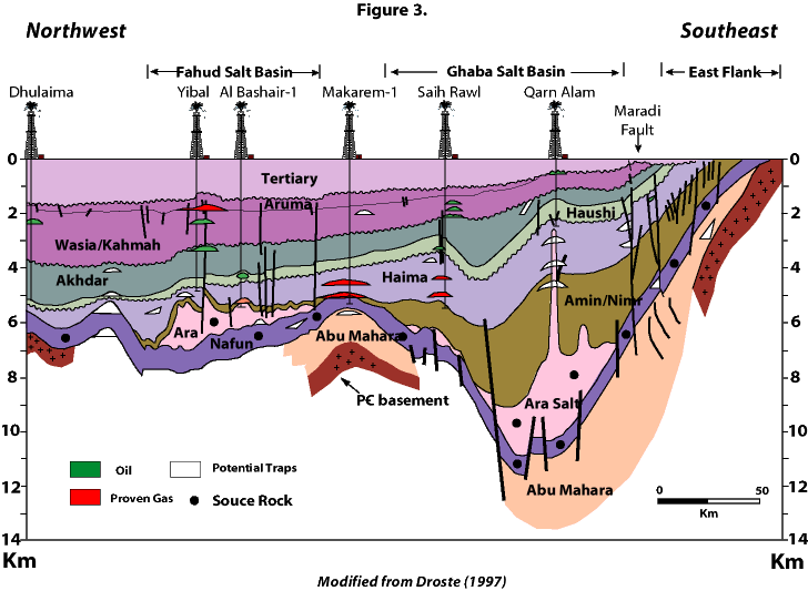
| Figure 3. Generalized northwest-southeast cross-section across northern Oman and the Ghaba Salt Basin, Central Oman Platform (Makarem High), and Fahud Salt Basin showing major oil and gas fields, proven occurrences, and potential traps (see figure 1 for location of line of section). See figure 5 for ages of units. Modified from Droste (1997). |
 |
| <<PREVIOUS Figure | Return to List of Figures |