
![]()
![]()
U.S. DEPARTMENT OF THE INTERIOR
U.S. GEOLOGICAL SURVEY
|
By
|
Open-File Report 99-50-C
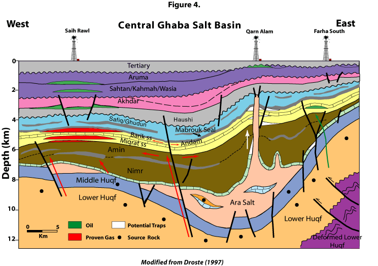
| Figure 4. Generalized east-west cross-section across central Ghaba Salt Basin showing major oil and gas fields, proven occurrences, and potential traps (see figure 1 for location of line of section). See figure 5 for ages of units. Modified from Droste (1997). |
 |
| <<PREVIOUS Figure | Return to List of Figures |