
![]()
![]()
U.S. DEPARTMENT OF THE INTERIOR
U.S. GEOLOGICAL SURVEY
|
By
|
Open-File Report 99-50-C
| system
is that portion of the system for which the presence of essential elements
and processes has been proved. The assessment unit is a mapable
volume of rock within the Total Petroleum System, sufficiently homogeneous
in terms of geology, exploration strategy, and risk characteristics to
constitute a single population with respect to criteria used for the chosen
methodology of resource assessment. The assessment unit, however, may be
limited to the data and information available for assessment of the resource(s),
thus limiting the degree of "homogeneity". Assessment units are considered
established
if they contain more than 13 fields, frontier if they contain 1-13
fields, and hypothetical if they contain no fields.
A unique eight-digit numeric code identifies each assessment unit with respect to the region, province, and Total Petroleum System. The first digit is the region number, the next three digits the province number, the next two digits the Total Petroleum System number, and the final two digits are the assessment number. The codes for the regions and provinces were established, listed in Klett and others (1997); provinces for the Arabian Penisula are listed and shown in greater detail in Pollastro and others (1998). Oil and gas production in Oman has grown considerably in the past 36 years to a present level of about 900,000 BOPD (U.S. Energy Information Administration, 1998; Petroleum Economist, 1998; Knott, 1998). Although conventional plays have been mostly identified with successful production, Oman has added at least one BBOE to their reserves in the past three years. In particular, non-associated deep-gas production and reserve calculations from frontier plays have exceeded industry expectations. These reasons further justify the need for a better understanding of the petroleum systems of Oman and a focused and specialized assessment of oil and gas resources in the Ghaba and Fahud Salt Basin Provinces. The Ghaba and Fahud Salt Basin Provinces are treated together here since they are geologically comparable and also both entirely within the country of Oman. |
||||
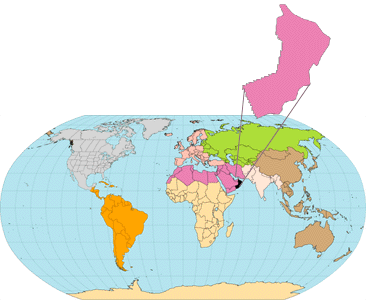
| INTRODUCTION The U.S. Geological Survey, World Energy Project, has divided the world into 8 regions and 937 geologic provinces for purposes of assessment of global oil and gas resources. These provinces have been ranked according to the discovered petroleum volumes within each; 76 "priority" provinces (high-ranking and exclusive of the U.S.) and 26 "boutique" provinces (chosen and exclusive of the U.S.) were designated for appraisal of oil and gas resources (Klett and others, 1997). The Ghaba and Fahud Salt Basin Provinces of Oman (USGS World Energy Project provinces 2014 and 2016, respectively; see Pollastro and others, 1998) are two of the 76 "priority" provinces; the Ghaba Salt Basin Province ranked number 69 and the Fahud Salt Basin Province ranked number 59. Total recoverable reserves are estimated at 5.0 billion barrels of oil equivalent (BBOE) for the Ghaba Salt Basin Province and 6.3 BBOE for the Fahud Salt Basin Province (Klett and others, 1997). The location and boundaries of these provinces are shown in figure 1. The largest field in the Ghaba Salt Basin is Saih Rawl (fig. 2). Yibal field (fig. 2) is the largest field of the Fahud Salt Basin, and in Oman in general; early conservative estimates of in place reserves at Yibal have been reported at about 3.0 billion barrels of stocktank oil (Litsey and others, 1983). Moreover, Yibal accounts for about 25 percent of Oman's developed reserves, currently producing about 217,000 barrels of oil per day (BOPD) (Knott, 1998). The Total Petroleum System concept is the basis for this assessment. A Total Petroleum System includes the essential elements and processes, as well as genetically related hydrocarbons that occur in petroleum shows, seeps, and accumulations (discovered and undiscovered), whose provenance is a pod or pods of mature source rock (concept modified from Magoon and Dow, 1994). The minimum petroleum |
||||
| <<PREVIOUS |
NEXT>>
|
| To Top of this Report |