|
The Ghaba Salt Basin, South Oman Salt Basin (2011; figs. 1, 2), and to
a lesser extent, the Fahud Salt Basin are part of a series of subsiding
rift basins stretching from India and Pakistan across the Arabian Shield
to central Iran that formed during the Infracambrian and lower Cambrian
(about 600 to 540 Ma). (Gorin and others, 1982; Husseini and Husseini,
1990; Mattes and Conway-Morris, 1990). These rift basins were formed by
extension from left-lateral, strike-slip (rifting and wrenching) movement
of the Najd transform fault system which ultimately dislocated the Arabian
plate some 300 km to the east (Schmidt and others, 1979). Generalized cross
sections across the Ghaba and Fahud Salt Basins are shown in figure
3 and figure 4.
Stratigraphy
The sedimentary section in the
hydrocarbon-producing provinces of Oman is made up of rocks ranging from
Proterozoic to Recent (Hughes-Clarke, 1988). Clastic rocks comprise most
of the lower Paleozoic part of the section, whereas, the Permian through
Tertiary (fig. 5) part of the section are predominantly
carbonate rocks and reflect climatic variations due to Oman's changing
paleolatitude through geologic time (Beydoun, 1991). For example, carbonate
platforms were dominant during periods when Oman was above 30 ° south
latitude. Earliest sediments of Oman are a clastic-carbonate-evaporite
sequence of the Huqf Supergroup (Droste, 1997) best known from outcrops
of the Huqf-Haushi swell (fig. 1 and fig.
2) and in the subsurface in southeast Oman (Gorin and others, 1982;
Hughes-Clarke, 1988). The Huqf Supergroup contains several clastic and
carbonate source rocks of exceptional quality; Huqf source rocks form the
basis of the primary petroleum systems for hydrocarbons produced throughout
Oman. The Cambrian Ara Formation is a carbonate/evaporite sequence with
thick salt deposits (up to 1000 m) (fig. 5).
The thick Ara evaporites were deposited in geographically-restricted basins
during periods of low relative sea level where stratified, anoxic conditions
periodically prevailed and organic-rich sediments and salt were deposited
(Mattes and Conway-Morris, 1990; Edgell, 1991) |
|
PROVINCE
GEOLOGY AND
PETROLEUM OCCURRENCE
Province Boundaries
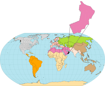
The Ghaba and Fahud Salt Basin
Provinces (fig. 1) are primarily defined
by their bounding structures and, for the most part, the geographic extent
of the deep, Cambrian Ara Salt. The Ghaba Salt Basin Province (2014) is
bounded on the east-southeast by the Huqf-Haushi Uplift and outcrops, to
the north by the Oman Mountains, to the northwest by the Central Oman Platform,
and to the south and southwest by the Central Oman High and Ghudun-Khasfah
High, respectively (fig. 2). The Fahud Salt Basin Province (2016) is bounded
on the northeast by the Oman Mountains, to the west by the Lekhwair-Safah
Arch, and to the south by the Central Oman Platform. The Makarem-Mabrouk
High, a northern extension of the Central Oman Platform (fig.
2), separates the two basins (Gorin and others, 1982; Boote and others,
1990; Robertson and others, 1990; Mattes and Conway-Morris, 1990; Loosveld
and others, 1996). Both the Ghaba and Fahud Salt Basin Provinces lie entirely
within the country of Oman (see Pollastro and others, 1998).
Structural Setting
Oman is located on the southeastern
margin of the Arabian plate and is close to the boundaries of the Iranian,
Indian, and African plates. Consequently, plate movements have resulted
in complex structural, sedimentation, and burial histories. Oman is tectonically
bounded on the south by the Gulf of Aden spreading zone, to the east by
the Masirah Transform Fault and the Owen Fracture Zone Trough, and to the
north by the complex Zagros-Makran convergent plate margin, compression
along which produced the Oman Mountains (Loosveld and others, 1996). Precambrian
metamorphic and igneous base- ment rocks are known from a limited number
of wells and from exposures of bedrock along the Huqf-Haushi Uplift on
Oman's eastern margin (fig. 1 and fig.
2). |
|