| Prev |
| Next |
| Map |
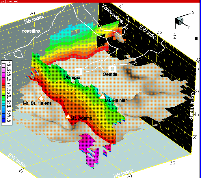
Figure 16--Row 16 indicates remnants of the SWCC north of Mt. Rainier, but the most significant feature is the complicated deep strucutre on the JDF (Juan de Fuca plate) near the southern margin of the most massive part of the 'mantle wedge' (click here to see this feature again). The mechanical resistance provided by the mantle wedge causes the JDF to take a locally steep dip.