

IRE & BSB Composite Aeromagnetic Map
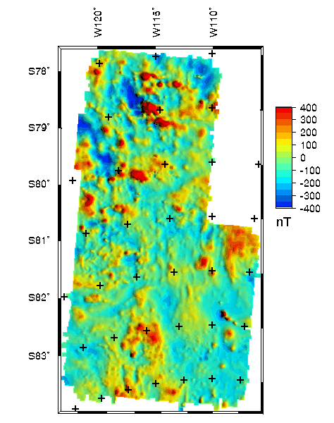
The IRE and BSB composite aeromagnetic map above was constructed
(see data processing details) from
data in the IRE and BSB regions of Central West Antarctica shown
on the data index plot. A data table summarizes the survey
specifications, including dates flown and original flight elevations.
[gridname = irebsb]
Top ||
Antarctica mag ||
References ||
Minerals ||
Geology ||
USGS
U.S. Department of the Interior
U.S. Geological Survey
This page is <URL: https://greenwood.cr.usgs.gov/pub/open-file-reports/ofr-99-0420/cwantarctica.html>
Maintained by: Gene Ellis
Last Modified Thursday, 19-Nov-1998 11:19:34 MST
For more information about this report contact: Ronald
Sweeney