

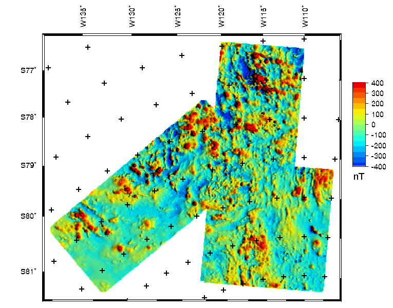
The Central West Antarctica composite aeromagnetic map above was constructed (see data processing details) from data in all the regions of Central West Antarctica shown on the data index plot. The continuation from the original flight elevation surface to a draped surface 1,500 meters above the bedrock elevation surface was performed using the chessboard method of Cordell and others (1992), applied with a moderate lowpass filter. A data table summarizes the survey specifications, including dates flown and original flight elevations. [gridname = rtz_bed1500]