Open-File Report 00-032
Data Acquisition and ProcessingWe used the M/V Tamnik, owned by the United States Geological Survey, Biological Resources Division, for our geophysical surveying. Combined side-scan-sonar imaging (side-scan) and seismic reflection profiling (profiling), and towed bottom camera work began on August 21 after two days of mobilization, and ended August 31 with one day of demobilization. Cruise activities are described in more detail in the cruise log. A Triton Elics Isis brand side-scan data recording system was used on the cruise, that simultaneously records 5 channels of data; port and starboard 100 KHz side-scan data, port and starboard 500 KHz side-scan data, and profiler data. Side-scan data shown in this report are 100 KHz data. Typically, 2048 samples were recorded per channel over a swath width of 200-400 m yielding a resolution of 0.1 - 0.5 m of seafloor area for the side-scan data. The resolution of the profiler data is 1-3 m of sub-bottom depth (with penetration of tens of meters in soft sediment and a few meters in harder sediment). The sidescan-sonar data were processed following the methodology of Chavez (1984), through use of The USGS Mini Image Processing System (MIPS). The slant-range, destripe, and beam pattern-processing routines, executed within MIPS, correct geometric and radiometric distortions inherent in the sonar data. The slant-range algorithm removes the water column artifact from the sonograph and corrects slant-range distance to true ground distance; the destripe routine corrects fluctuations in adjacent ping values within the sonar record; the beam pattern routine corrects variations in beam intensity with range. The processed data files were mosaiced to form a composite image. A linear stretch was applied to the final mosaics to enhance the contrast between low and high backscatter areas. The final mosaics were exported from MIPS in TIFF format. The TIFF images were imported into an arc/info database (Geiselman et al., 1997) that contained coastline, geology, and bathymetry coverages. The processed data will be released in a future report. 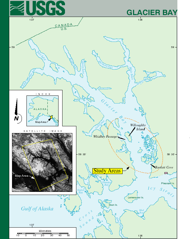 Figure 1 (195K) Figure 1 (195K)
|
|
|
For more information, contact the PCMSC team.
This report is preliminary and has not been reviewed for conformity with U.S. Geological Survey editorial standards or with the North American Stratigraphic Code. Use of trade, product, or firm names in this report is for descriptive purposes only and does not imply endorsement by the U.S. Government. Any use of trade, product, or firm names is for descriptive purposes only and does not imply endorsement by the U.S. Government. Suggested citation: U.S. Department of the Interior U.S. Geological Survey |

![]() U.S. Department of the Interior |
U.S. Geological Survey
U.S. Department of the Interior |
U.S. Geological Survey
URL: http://pubsdata.usgs.gov/pubs/of/2000/0032/data.html
Page Contact Information: GS Pubs Web Contact
Page Last Modified: Wednesday, 07-Dec-2016 18:16:24 EST
