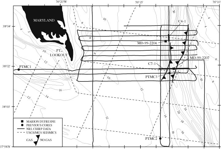
| Figure 3.1 Geophysical data, core locations, and extent of primary biogenic methane zone at intersection of Potomac River and Chesapeake Bay. See Figure 2-1 for location. Seismic profiles of Colman and Halka (1988) and Colman and others (1991) indicated by dashed lines, with 1999 NRL chirp data collected along solid lines (profiles along thickened segments, labeled C4-1 and C7-1 are shown with interpretations in Figs. 3.2 and 3.3). Marion-Dufresne core sites showwn by squares, previously collected shorter cores by filled circles. Toothed line shows edge of main biogenic methane bubble zone associated with present and paleochannel axis. NOAA bathymetry at 2 meter contour interval. |
TO RETURN TO REPORT, CLOSE THIS WINDOW.
U.S. Department of Interior, U.S. Geological Survey
URL of this page: https://pubs.usgs.gov/openfile/of00-306/chapter3/fig3-1.html
Maintained by: Eastern Publications Group Web Team
Last modified: 03.28.01 (krw)