Woods Hole Field Center Home Page Coastal and Marine Geology Program Home Page U.S. Geological Survey with link to U.S.G.S. Home Page
USGS Banner
 

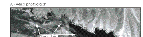
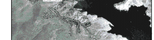
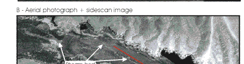
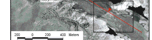
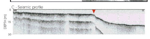
Surficial Geology and Distribution of Post-Impoundment Sediment in Las Vegas Bay, Lake Mead


Figure 9.   Orthophotograph taken in 1996 when the lake was about 4-m lower than when this survey was conducted showing a stream and subaerial part of the delta. B. Sidescan sonar image superimposed on orthophotograph for reference showing the same stream bed that now is submerged. The red line marks the location of the seismic profile shown in C, and the red arrow marks the transition from delta top to delta front. Box outlines area shown in Figure 10.

Click on area of map to zoom in

Figure 9.  Orthophotograph taken in 1996 when the lake was about 4-m lower than when this survey was conducted showing a stream and subaerial part of the delta.


 Back to Top  Title Page

 Introduction  Methods  Results  Discussion  Summary  References

[an error occurred while processing this directive]