U. S. Geological Survey Open-File Report 01-154
|
|
|
U. S. Geological Survey Open-File Report 01-154 |
SEA-FLOOR PHOTOGRAPHY FROM THE CONTINENTAL MARGIN PROGRAM:A Pictorial Survey of Benthic Character and Habitats
|
|
Photographic Gallery of personnel, facilities and equipment from the Continental Margin Program |
|
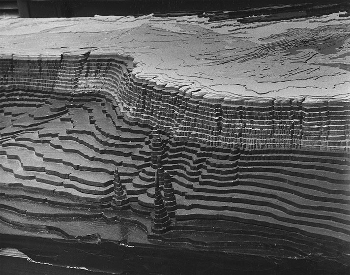
Like an underwater "Grand Canyon", this model of the Atlantic Continental Shelf and Slope rises abruptly in exaggerated terraces toward the Continental Shelf - with Delaware Bay, Long Island , and Cape Cod marking the U.S. coastline in the distance. The pagoda-like spirals in the foreground are seamounts rising from the the ocean floor. The model was constructed by a team of Woods Hole Oceanographic Institution - U.S. Geological Survey geologists in 1964, patterned after a new series of Continental Shelf and Slope maps - just published by the two organizations. |