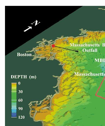
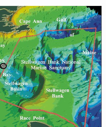
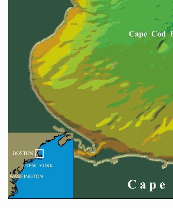
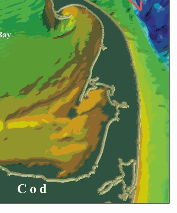
Skip past header information USGS Logo with Link to USGS Home Page
  Open File Report 01-499, Temporal Changes in Grain Size and Organic-Mineral Aggregates
Skip past header information
Title Page / Abstract / Introduction / Geologic / Methods / Results / Conclusions / Acknowledgments / References / Appendix 1


Figure 1

Location of the Massachusetts Bay outfall site showing its proximity to the Stellwagen Bank National Marine Sanctuary to the east and Cape Cod to the south. MBDS is the Massachusetts Bay Disposal site for dredged material. On September 6, 2000, the outfall from Boston's secondary sewage treatment plant was moved from the mouth of Boston Harbor to the Massachusetts Bay Outfall location, whichis shown at the seaward end of the black line in the northwest corner of the Bay. A tunnel 9.5 miles long and 24 feet in diameter carries about 380 million gallons per day of treated sewage effluent. The effluent is discharged through 50 diffuse caps on the eafloor along the last mile of the tunnel.

Figure 1. Location of the Massachusetts Bay outfall site showing its proximity to the Stellwagen Bank National Marine Sanctuary to the east and Cape Cod to the south. Figure 1. Location of the Massachusetts Bay outfall site showing its proximity to the Stellwagen Bank National Marine Sanctuary to the east and Cape Cod to the south.


Skip past header information Title Page / Abstract / Introduction / Geologic / Methods / Results / Conclusions / Acknowledgments / References / Appendix 1
[an error occurred while processing this directive]