 |
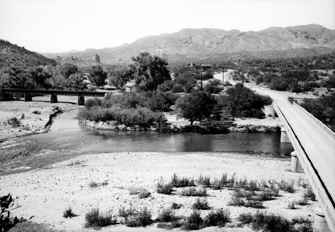
(May 21, 1945). This view, from a hill on the south side of the
Gila River, shows the bridge at Kelvin from which discharge measurements
are made at high flows. The river flows from right to left in this
view and is regulated by Coolidge Dam, completed in 1928. The largest
historic flood at this station is 132,000 ft³/s in 1916, and
three other annual flood peaks exceeded 40,000 ft³/s before 1945.
Floods were less than 40,000 ft³/s for 15 years prior to this
photograph. Tamarisk is becoming established in the foreground, and
mesquite and cottonwood trees appear on the far bank. Mineral Creek,
spanned by a railroad bridge, enters the Gila River at left (W.L.
Heckler, #3709). |
| |
|
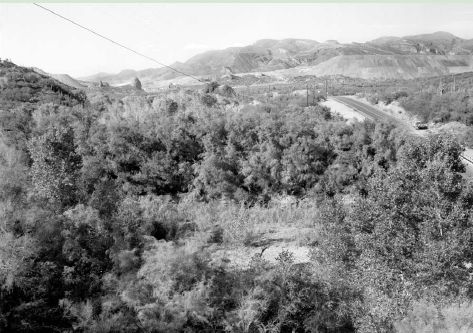 |
(October 2, 2000). The view is blocked by cottonwood trees, particularly
at left and right with small trees in the foreground, and large tamarisk
trees. This increase in riparian vegetation has occurred despite the
fact that floods of 100,000 and 74,900 ft³/s, in 1983 and 1993
respectively, passed through this reach (Dominic Oldershaw, Stake
430). |
|
|
|
