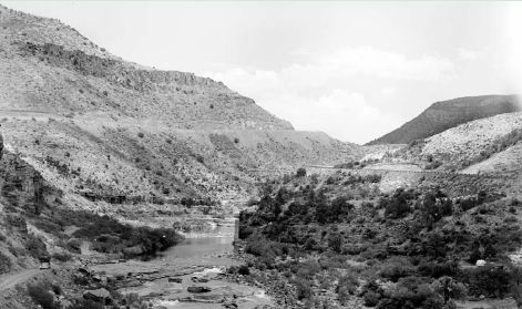
| (November 26, 1935). This upstream view from the old, two-lane bridge that crosses the Salt River in Salt River Canyon shows a relatively small discharge of 277 ft³/s. Scattered native shrubs, including willows and brickellbush, appear to occupy the floodplain at right center. The road leading to Show Low, Arizona, appears as a one-lane cut through the hillslope at center (R.E. Cook, #2280). |  |
||||
|
|||||
| (October 25, 2000). The water level is only slightly higher than in 1964. In the intervening 36 years, two floods exceeded 70,000 ft³/s and four have exceeded 50,000 ft³/s. Despite these floods, riparian vegetation along the banks has increased, particularly non-native tamarisk. The palm trees have grown considerably (Dominic Oldershaw, Stake 363). | 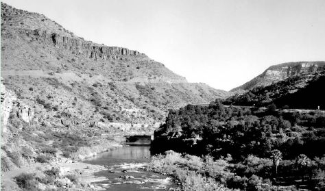 |
||||
|
Next: San Carlos River Near Peridot (09468500) |
|||||