 |
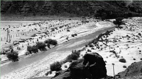
(ca. 1964-1968). In this upstream view, the photographer documented channel conditions in the reach just upstream from the gaging station. A small cottonwood tree appears at right center, just right of a relatively straight channel reach that undoubtedly was used for indirect-discharge estimates. The shrubs on both sides of the river are probably tamarisk, with other perennial shrubs on the broad floodplain at right (photographer unknown). |
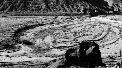
| (January 19, 1984). The channel of the Paria River has changed significantly in this view. The cottonwood tree is gone, probably killed during one of the relatively small floods that have swept down the Paria River since the original photograph. The array of terraces suggests that considerable sediment has been stored along the floodplain on river left, probably during floods in 1980. Sediment has been removed from the floodplain on river right; note the near-vertical bank at left. The fence that once kept livestock out of the channel has been removed by erosion (Richard Hereford, Stake 1379). |  |
Next: Salt River Near Chrysotile (09497500)
Previous: Virgin River at Littlefield (09415000)
Back: Introduction
