|
|
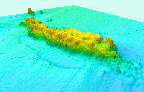
Thumbnails
 |
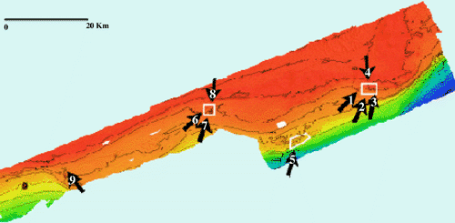
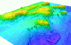
1. Oblique view of color shaded-relief bathymetry of Yellow Tail Reef, Pinnacles Region, Gulf of Mexico. The view is looking northeast (See arrow 1 on the index map above for location). The isobaths are in meters below sea level, the distance across the bottom of the image is approximately 600 meters, and the vertical exaggeration is 5x. Larger view, JPEG (43kb). |
 |
2. Oblique color shaded-relief view of Cat's Paw Reef, Pinnacles Region, Gulf of Mexico. The view is looking northeast (See arrow 2 on the index map above for location). The isobaths are in meters below sea level, the distance across the bottom of the image is approximately 700 meters, and the vertical exaggeration is 5x. Larger view, JPEG (51kb). |
 |
3. Oblique color shaded-relief bathymetry view of Roughtongue Reef, Pinnacles Region, Gulf of Mexico. The view is looking northeast (See arrow 3 on the index map abovefor location). The isobaths are in meters below sea level, the distance across the bottom of the image is approximately 600 meters, and the vertical exaggeration is 5x. Larger view, JPEG (49kb). |
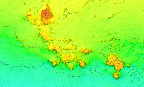 |
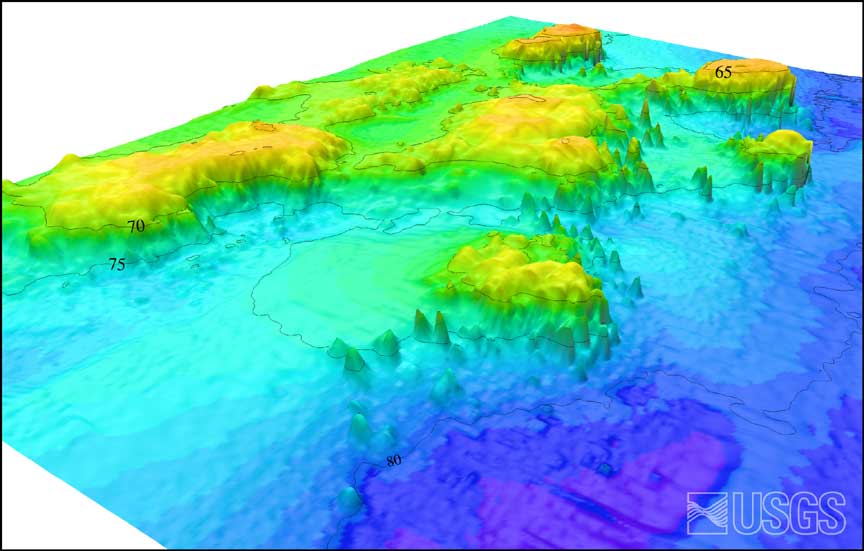
4. Color Shaded-Relief Bathymetry of 40-Fathom Reef, Pinnacles Region, Gulf of Mexico (See the index map above for location). The isobaths are in meters below sea level and the distance across the bottom of the image is approximately 2 kilometers. Reds and oranges show the shallower depths of the reefs, while the yellows and greens show the deeper depths of the surrounding seafloor. Larger view, JPEG (60kb). |
 |
5. Oblique color shaded-relief view of the Pinnacles Reef Complex, Gulf of Mexico. The view is looking northeast (See arrow 5 on the index map above for location). The isobaths are in meters below sea level, the distance across the bottom of the image is approximately 700 meters, and the vertical exaggeration is 5x. Larger view, JPEG (47kb). |
 |
6. Oblique color shaded-relief view of Triple Top Reef, Pinnacles Region, Gulf of Mexico. View is looking northeast (See arrow 6 on the index map abovefor location). The isobaths are in meters below sea level, the distance across the bottom of the image is approximately 800 meters, and the vertical exaggeration is 5x. Larger view, JPEG (57kb). |
 |
7. Oblique color shaded-relief view of Double Top Reef, Pinnacles Region, Gulf of Mexico. View is looking northeast (See arrow 7 on the index map above for location). The isobaths are in meters below sea level, the distance across the bottom of the image is approximately 700 meters, and the vertical exaggeration is 5x. Larger view, JPEG (66kb). |
 |
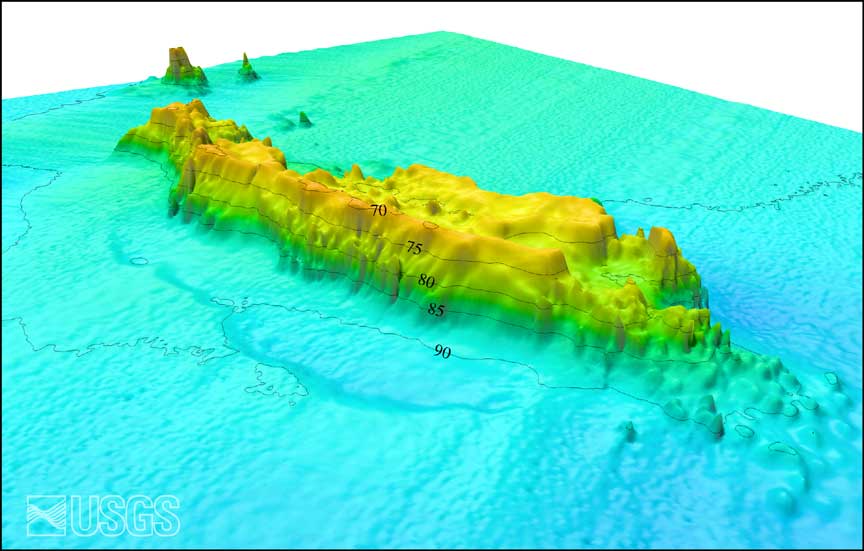
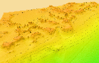
8. Shaded Relief bathymetry of Triple Top and Double Top Reef Complexes, Pinnacles Region, Gulf of Mexico (See arrow 8 on the index map above for location). The isobaths are in meters below sea level, the distance across the bottom of the image is approximately 2 kilometers, and the vertical exaggeration is 5x. Larger view, JPEG (128kb). |
 |
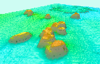
9. Oblique color shaded-relief view and bathymetric profile of Alabama Alps Reef, Pinnacles Region, Gulf of Mexico. The view is looking northwest (See arrow 9 on the index map above for location). The isobaths are in meters below sea level, the distance across the bottom of the image is approximately 700 meters, and the vertical exaggeration is 5x. Larger view, JPEG (51kb). |
|

![[Reports]](http://walrus.wr.usgs.gov/images/nav_rprt.gif)

![[Home]](http://walrus.wr.usgs.gov/images/nav_home.gif)
![[Search]](http://walrus.wr.usgs.gov/images/nav_srch.gif)