| |  |  | | Lake Pontchartrain Atlas: | | | | | | | | | | | | | | | | | | | | | | | | | Basin Geology |  | | | | | | | | | | | | | | | | | | | |  | | | | | | | | | | |  | Basin Geology - Geomorphology Contributors: Beall, Zganjar, Westphal, Penland 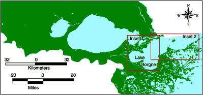 | | Figure 49: Location map for Lake Borgne. | 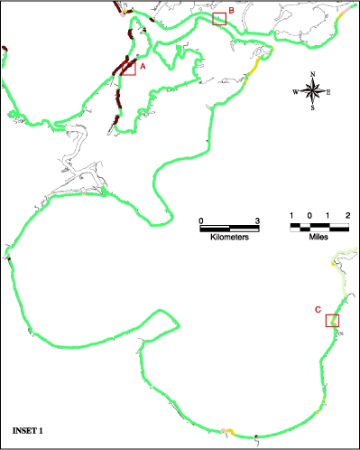
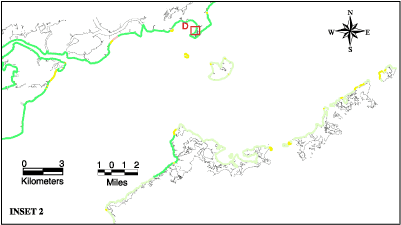 | Legend |  | Shell Beach
A beach of high relief made up predominately of shell. |  | Sand Beach
A beach made up of fine or coarse grain sand. |  | Brackish Marsh
Any unforested, vegetated area normally subject to inundation or tidal action at any time sufficient to support wetland-development, emergent vegetation with salinity between 8-16 ppt. |  | Salt Marsh
Any unforested, vegetated area normally subject to inundation or tidal action at any time sufficient to support wetland-development, emergent vegetation with salinity between 16-40 ppt. |  | Riprap Armor
Embankment or revetment along a shoreline reinforced by things thrown together without order in the form of broken concrete, concrete blocks, old pilings, rubble, etc. to resist erosion. |  | Bulkhead
A wood, steel, or concrete wall along a waterfront. Can be adjacent to the land as a retaining wall or separate from it as a seawall to provide wave protection and resist erosion. | | | | Figure 50: Shoreline types of Lake Borgne. (Click on a letter to see a photograph of the shoreline.) |
« Previous | Next » |
