| |  |  | | Lake Pontchartrain Atlas: | | | | | | | | | | | | | | | | | | | | | | | | | Basin Geology |  | | | | | | | | | | | | | | | | | | | |  | | | | | | | | | | |  | Basin Geology - Geomorphology Contributors: Beall, Zganjar, Westphal, Penland 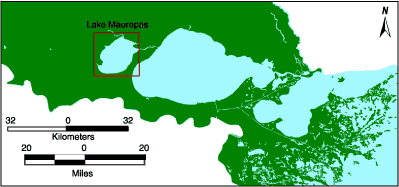 | | Figure 39: Location map for Lake Maurepas. | 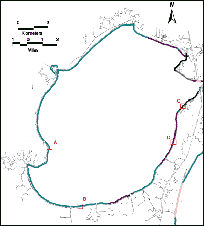
| Legend |  | Swamp
Any forested area normally subject to inundation through part of the growing season or with permanent or near-permanent standing water. |  | Fresh Marsh
Any unforested, vegetated area normally subject to inundation or tidal action at any time sufficient to support wetland-dependent, emergent vegetation with salinity less than 0.5 ppt. |  | Bank
Natural riverine or lacustrine bank with grass and trees. |  | Riprap Armor
Embankment or revetment along a shoreline reinforced by things thrown together without order in the form of broken concrete, concrete blocks, old pilings, rubble, etc. to resist erosion. |  | Swamp with Fresh Marsh
An area of swamp at the shoreline that contains a fresh marsh (salinity less than 0.5 ppt) behind the shoreline. | | | | Figure 40: Shoreline types of Lake Maurepas. Based on Summer 1996 aerial video survey. (Click on a letter to see a photograph of the shoreline.) | « Previous | Next » |
