Link to USGS home page
Coastal and Marine Geology Program

Trackline Map

Home | Read Me | Cruise Activity | Navigation Data | Seismic Data | USGS Software | Seismic Unix | Disclaimer


Full Survey Area
USGS Cruise 97KEY01
Florida Keys, 1997

Trackline Map displaying all the boomer seismic tracklines collected during USGS Cruise 97KEY01, with hotlinks to each Area for more detailed maps.

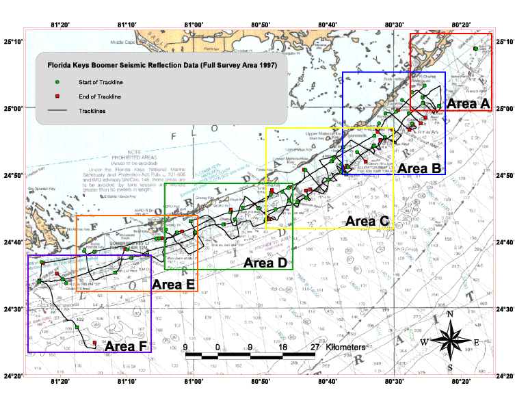
NOTE: This is a clickable map. Click on the appropriate colored boxes to view the area in question with more detail.


Home | Read Me | Cruise Activity | Navigation Data | Seismic Data | USGS Software | Seismic Unix | Disclaimer


[an error occurred while processing this directive]