USGS: science for a changing world - www.usgs.gov
Coastal and Marine Geology Program home - marine.usgs.gov
  U.S. Geological Survey Open-File Report 03-001

BROWSE THUMBNAIL IMAGE: Image showing extent and distribution of data layer coverage.

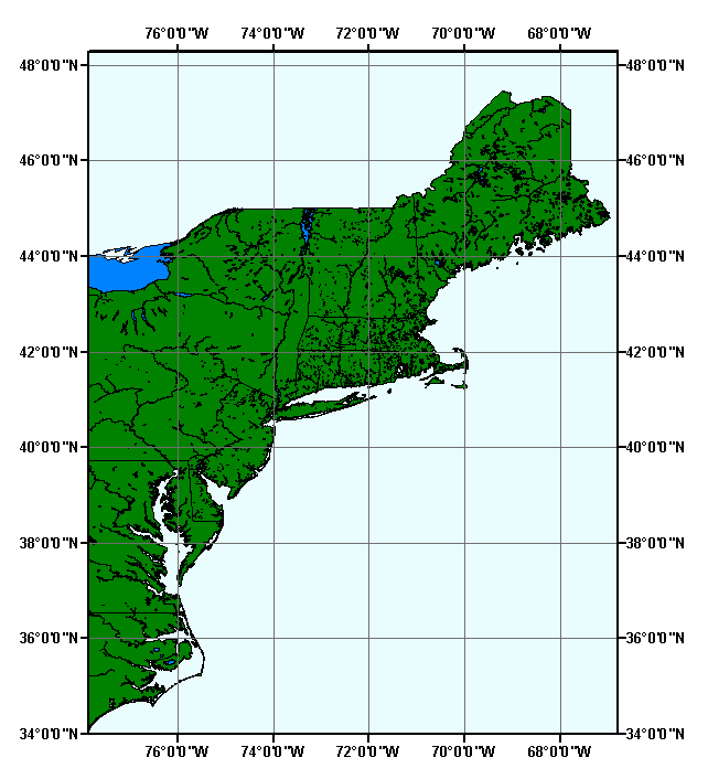
LAKES: major lakes of the northeast United States


Metadata also available as: FAQ - TEXT

MJWATER: Major Water of the Northeast United States

Metadata:


Identification_Information:
Citation:
Citation_Information:
Originator: Valerie Paskevich
Publication_Date: 2003
Title: MJWATER: Major Water of the Northeast United States
Edition: 1.1
Geospatial_Data_Presentation_Form: vector digital data
Publication_Information:
Publication_Place: Woods Hole Field Center, Woods Hole, MA
Publisher: U.S. Geological Survey, Coastal and Marine Geology Program
Online_Linkage:
<http://pubs.usgs.gov/of/2003/of03-001/data/basemaps/usa/water/mjwater.zip>
Online_Linkage:
<http://pubs.usgs.gov/of/2003/of03-001/data/basemaps/usa/water/mjwater.zip>
Larger_Work_Citation:
Citation_Information:
Originator: L.J. Poppe
Originator: V.F. Paskevich
Originator: S.J. Williams
Originator: M.E. Hastings
Originator: J.T. Kelley
Originator: D.F. Belknap
Originator: L.G. Ward
Originator: D.M. FitzGerald
Originator: P.F. Larsen
Publication_Date: 2003
Title:
Surficial Sediment Data from the Gulf of Maine, Georges Bank, and vicinity: a GIS Compilation
Edition: 1.0
Series_Information:
Series_Name: Open-File Report
Issue_Identification: 03-001
Publication_Information:
Publication_Place: Woods Hole Field Center, Woods Hole, MA
Publisher: U.S. Geological Survey, Coastal and Marine Geology Program
Other_Citation_Details:
Data is released via CD-ROM media. This digital publication may also be available via the web at pubs.usgs.gov
Online_Linkage: <http://pubs.usgs.gov/of/2003/of03-001>
Online_Linkage: <http://woodshole.er.usgs.gov/openfile/of03-001>
Description:
Abstract:
U.S. Major Water represents areas that are major water features within United States.
Purpose:
U.S. Major Water provides thousands of named major water areas such as bays, canals, lakes, reservoirs, and large rivers. U.S. Major Water is detailed enough for geographic display at local, regional, and national levels.
Supplemental_Information:
Major water of the United States (MJWATER) is an ESRI shapefile with polygon features. This is a subset of the original dataset. It has been clipped to the extent of the Gulf of Maine surficial sediment GIS project area.

Largest scale when displaying the data: 1:100,000.

Time_Period_of_Content:
Time_Period_Information:
Multiple_Dates/Times:
Single_Date/Time:
Calendar_Date: 199710
Single_Date/Time:
Calendar_Date: 199901
Single_Date/Time:
Calendar_Date: 200001
Currentness_Reference: publication date
Status:
Progress: Complete
Maintenance_and_Update_Frequency: Matches software update releases
Spatial_Domain:
Bounding_Coordinates:
West_Bounding_Coordinate: -77.909625
East_Bounding_Coordinate: -67.121681
North_Bounding_Coordinate: 47.385054
South_Bounding_Coordinate: 34.971978
Keywords:
Theme:
Theme_Keyword_Thesaurus: None
Theme_Keyword: polygon
Theme_Keyword: water
Theme_Keyword: hydrography
Theme_Keyword: bays
Theme_Keyword: canals
Theme_Keyword: lakes
Theme_Keyword: reservoirs
Theme_Keyword: rivers
Theme_Keyword: inlandWaters
Place:
Place_Keyword_Thesaurus: None
Place_Keyword: United States
Temporal:
Temporal_Keyword_Thesaurus: None
Temporal_Keyword: 1997
Temporal_Keyword: 1999
Temporal_Keyword: 2000
Access_Constraints: Access granted to Licensee only.
Use_Constraints:
The data are provided by multiple, third party data vendors under license to ESRI for inclusion on ESRI Data & Maps CD-ROMs for use with ESRI® software. Each data vendor has its own data licensing policies and may grant varying redistribution rights to end users. Please consult the redistribution rights below for this data set provided on ESRI Data & Maps CD-ROMs. As used herein, "Geodata" shall mean any digital data set consisting of geographic data coordinates and associated attributes.

The redistribution rights for this data set: Redistribution rights are granted by the data vendor for hard-copy renditions or static, electronic map images (e.g. .gif, .jpeg, etc.) that are plotted, printed, or publicly displayed with proper metadata and source/copyright attribution to the respective data vendor(s). Geodata is redistributable with a Value-Added Software Application developed by ESRI Business Partners on a royalty-free basis with proper metadata and source/copyright attribution to the respective data vendor(s).

The terms and conditions below apply to all the data sets provided on the ESRI Data & Maps CD-ROMs.

Proprietary Rights and Copyright: Licensee acknowledges that the Data and Related Materials contain proprietary and confidential property of ESRI and its licensor(s). The Data and Related Materials are owned by ESRI and its licensor(s) and are protected by United States copyright laws and applicable international copyright treaties and/or conventions.

Limited Warranty and Disclaimer: ESRI warrants that the media upon which the Data and Related Materials are provided will be free from defects in materials and workmanship under normal use and service for a period of ninety (90) days from the date of receipt.

THE DATA AND RELATED MATERIALS ARE EXCLUDED FROM THE LIMITED WARRANTY, AND THE LICENSEE EXPRESSLY ACKNOWLEDGES THAT THE DATA CONTAINS SOME NONCONFORMITIES, DEFECTS, OR ERRORS. ESRI DOES NOT WARRANT THAT THE DATA WILL MEET LICENSEE'S NEEDS OR EXPECTATIONS; THAT THE USE OF THE DATA WILL BE UNINTERRUPTED; OR THAT ALL NONCONFORMITIES, DEFECTS, OR ERRORS CAN OR WILL BE CORRECTED. ESRI IS NOT INVITING RELIANCE ON THIS DATA, AND THE LICENSEE SHOULD ALWAYS VERIFY ACTUAL DATA.

EXCEPT FOR THE LIMITED WARRANTY SET FORTH ABOVE, THE DATA AND RELATED MATERIALS CONTAINED THEREIN ARE PROVIDED "AS-IS," WITHOUT WARRANTY OF ANY KIND, EITHER EXPRESS OR IMPLIED, INCLUDING, BUT NOT LIMITED TO, THE IMPLIED WARRANTIES OF MERCHANTABILITY AND FITNESS FOR A PARTICULAR PURPOSE.

Exclusive Remedy and Limitation of Liability: The entire liability of ESRI or its licensor(s) and Licensee's exclusive remedy shall be to terminate the Agreement upon Licensee returning the Data and Related Materials to ESRI with a copy of Licensee's invoice/receipt and ESRI returning the license fees paid to Licensee.

IN NO EVENT SHALL ESRI AND/OR ITS LICENSOR(S) BE LIABLE FOR COSTS OF PROCUREMENT OF SUBSTITUTE GOODS OR SERVICES; LOST PROFITS, LOST SALES, OR BUSINESS EXPENDITURES, INVESTMENTS, OR COMMITMENTS IN CONNECTION WITH ANY BUSINESS; LOSS OF ANY GOODWILL; OR FOR ANY INDIRECT, SPECIAL, INCIDENTAL, EXEMPLARY, OR CONSEQUENTIAL DAMAGES ARISING OUT OF THIS AGREEMENT OR USE OF THE DATA AND RELATED MATERIALS, HOWEVER CAUSED, ON ANY THEORY OF LIABILITY, AND WHETHER OR NOT ESRI OR ITS LICENSOR(S) HAVE BEEN ADVISED OF THE POSSIBILITY OF SUCH DAMAGE. THESE LIMITATIONS SHALL APPLY NOTWITHSTANDING ANY FAILURE OF ESSENTIAL PURPOSE OF ANY EXCLUSIVE REMEDY.

Third Party Beneficiary: ESRI's licensor(s) has (have) authorized ESRI to (sub)distribute and (sub)license its (their) data as incorporated into the Data and Related Materials. As an intended third party beneficiary to this Agreement, the ESRI licensor(s) is (are) entitled to directly enforce, in its own name, the rights and obligations undertaken by the Licensee and to seek all legal and equitable remedies as are afforded to ESRI.

In the event that the data vendor(s) has (have) granted the end user permission to redistribute the Geodata, please use proper proprietary or copyright attribution for the various data vendor(s), and provide the associated metadata file(s) with the Geodata. In compliance with FGDC metadata standards, ESRI has attempted to practice proper metadata methodologies by providing any data source information, descriptions, and file names to assist in this effort.

Point_of_Contact:
Contact_Information:
Contact_Organization_Primary:
Contact_Organization: Environmental Systems Research Institute, Inc. (ESRI)
Contact_Person: Data Team
Contact_Address:
Address_Type: mailing and physical address
Address: 380 New York Street
City: Redlands
State_or_Province: California
Postal_Code: 92373-8100
Country: USA
Contact_Voice_Telephone: 909-793-2853
Contact_Facsimile_Telephone: 909-793-5953
Contact_Electronic_Mail_Address: info@esri.com
Hours_of_Service: 8:00 a.m.-5:30 p.m. Pacific time, Monday-Friday
Contact_Instructions:
In the United States: Please direct all inquiries regarding software/data pricing and consulting services to your local ESRI Regional Office. For support, you may contact Technical Support by telephone (voice) between 6:00 a.m. and 6:00 p.m. Pacific time, Monday through Friday, by dialing 909-793-3774; facsimile (fax) available at 909-792-0960; electronic mail (e-mail) support@esri.com; or visit <http://support.esri.com>; ESRI holidays excluded.

Outside the United States: Please direct all inquiries regarding software/data pricing, sales, support, and consulting services to your local ESRI International Distributor. This information can be found at <http://gis.esri.com/intldist/contactint.cfm>.

For other questions or comments, you may contact ESRI headquarters by e-mail, telephone, or fax or write to us.

Browse_Graphic:
Browse_Graphic_File_Name: mjwater
Browse_Graphic_File_Description:
Overview showing the extent of the clipped MJWATER shapefile for the Gulf of Maine surficial sediment GIS project area.
Browse_Graphic_File_Type: GIF
Native_Data_Set_Environment:
Microsoft Windows 2000 Version 5.1 (Build 2600) ; ESRI ArcCatalog 8.2.0.700

Data_Quality_Information:
Logical_Consistency_Report:
No duplicate features are present. The shapefile is exported using Avenue request ExportClean. This request verifies and enforces the correctness of shapes.
Completeness_Report:
After processing, the data set is checked for drawing display and number of records and file sizes compared with source materials.
Positional_Accuracy:
Horizontal_Positional_Accuracy:
Horizontal_Positional_Accuracy_Report:
The geospatial part of this data set was extracted from the 1990 Census Version TIGER/Line - files (CD-ROM edition). To improve the shape accuracy, GDT ran a process to identify irregular features and give them more accurate shapes. It was then generalized to a tolerance of 27 feet. Due to the processing, the positional accuracy in unknown but close to the original TIGER/line files of +/- 167 feet approximately.

The positional accuracy of the TIGER/Line coordinates varies with the source materials used but at best meets the established National Map Accuracy standards (+/- 167 feet approximately) where 1:100,000-scale maps from the USGS are the source. The Census Bureau cannot specify the accuracy of feature updates added by its field staff or of features derived from the GBF/DIME-Files or other map sources. Thus, the level of positional accuracy in the TIGER/Line files is not suitable for high-precision measurement applications such as engineering problems, property transfers, or other uses that might require highly accurate measurements of the earth's surface.

Lineage:
Source_Information:
Source_Citation:
Citation_Information:
Originator: Geographic Data Technology, Inc.
Publication_Date: 199710
Title: Dynamap/2000 v7.3
Edition: Version 7.3
Geospatial_Data_Presentation_Form: vector digital data
Series_Information:
Series_Name: Dynamap/2000®
Issue_Identification: v7.3
Publication_Information:
Publication_Place: Lebanon, New Hampshire, USA
Publisher: Geographic Data Technology, Inc
Source_Scale_Denominator: 100000
Type_of_Source_Media: CD-ROM
Source_Time_Period_of_Content:
Time_Period_Information:
Single_Date/Time:
Calendar_Date: 199710
Source_Currentness_Reference: publication date
Source_Citation_Abbreviation: GDT Dynamap/2000 v7.3
Source_Contribution: Attribute and geospatial data
Source_Information:
Source_Citation:
Citation_Information:
Originator: Geographic Data Technology, Inc.
Publication_Date: 199901
Title: Dynamap/2000 v9.0
Edition: Version 9.0
Geospatial_Data_Presentation_Form: vector digital data
Series_Information:
Series_Name: Dynamap/2000®
Issue_Identification: v9.0
Publication_Information:
Publication_Place: Lebanon, New Hampshire, USA
Publisher: Geographic Data Technology, Inc
Source_Scale_Denominator: 100000
Type_of_Source_Media: CD-ROM
Source_Time_Period_of_Content:
Time_Period_Information:
Single_Date/Time:
Calendar_Date: 199901
Source_Currentness_Reference: publication date
Source_Citation_Abbreviation: GDT Dynamap/2000 v9.0
Source_Contribution: Attribute and geospatial data
Source_Information:
Source_Citation:
Citation_Information:
Originator: Geographic Data Technology, Inc.
Publication_Date: 200001
Title: Dynamap/2000 v10.0
Edition: Version 10.0
Geospatial_Data_Presentation_Form: vector digital data
Series_Information:
Series_Name: Dynamap/2000®
Issue_Identification: v10.0
Publication_Information:
Publication_Place: Lebanon, New Hampshire, USA
Publisher: Geographic Data Technology, Inc.
Source_Scale_Denominator: 100000
Type_of_Source_Media: CD-ROM
Source_Time_Period_of_Content:
Time_Period_Information:
Single_Date/Time:
Calendar_Date: 200001
Source_Currentness_Reference: publication date
Source_Citation_Abbreviation: GDT Dynamap/2000 v10.0
Source_Contribution: Attribute and geospatial data
Process_Step:
Process_Description:
This data set is a TIGER-derived product, which by definition "line only" based files. In many cases these line segments followed the actual shape only roughly. To remedy this, a process was developed to identify irregular features and give them more accurate shapes. Although lines are reasonable for streets, they often do not represent areas such as water very well. A river, for example, is represented by two lines that correspond to the two shorelines. In order for a GIS user to represent this river in a way that makes sense on a map, it is necessary to manually join the lines into a polygon that can be filled with an appropriate color. GDT applied both algorithmic and manual processes to create separate polygonal layers for water areas.
Process_Date: 200001
Source_Produced_Citation_Abbreviation: GDT Dynamap/2000 v7.3
Source_Produced_Citation_Abbreviation: GDT Dynamap/2000 v9.0
Source_Produced_Citation_Abbreviation: GDT Dynamap/2000 v10.0
Process_Step:
Process_Description:
The following steps were performed by ESRI: Extracted data set from GDT Dynamap/2000 v7.3. Added all updates and changes manually from Dynamap/2000 v9.0. Converted to North American Datum of 1983 (NAD83). Generalized to a tolerance of 0.005 miles (27 feet). Corrected an error on the Potomac River using Dynamap/2000 v10.0 as source. Created ArcGIS? layer file (.lyr). Created ArcView legend file (.avl). Created projection file (.prj). Ran ArcView Avenue request ExportClean, and created spatial indices.
Source_Used_Citation_Abbreviation: GDT Dynamap/2000 v7.3
Source_Used_Citation_Abbreviation: GDT Dynamap/2000 v9.0
Source_Used_Citation_Abbreviation: GDT Dynamap/2000 v10.0
Process_Date: 20000630
Process_Step:
Process_Description:
The original shapefile was clipped to to the extent of the Gulf of Maine surficial sediment GIS project area.
Source_Used_Citation_Abbreviation: mjwater.dbf
Source_Used_Citation_Abbreviation: mjwater.shp
Source_Used_Citation_Abbreviation: mjwater.shx
Process_Date: 20021102
Source_Produced_Citation_Abbreviation: mjwater.dbf
Source_Produced_Citation_Abbreviation: mjwater.shp
Source_Produced_Citation_Abbreviation: mjwater.shx
Process_Contact:
Contact_Information:
Contact_Person_Primary:
Contact_Person: Valerie Paskevich
Contact_Organization: U.S. Geological Survey
Contact_Position: Information Specialist
Contact_Address:
Address_Type: mailing and physical address
Address: 384 Woods Hole Road
City: Woods Hole
State_or_Province: MA
Postal_Code: 02543-1598
Country: USA
Contact_Voice_Telephone: (508) 548-8700 x2281
Contact_Facsimile_Telephone: (508) 457-2310
Contact_Electronic_Mail_Address: vpaskevich@usgs.gov

Spatial_Data_Organization_Information:
Direct_Spatial_Reference_Method: Vector
Point_and_Vector_Object_Information:
SDTS_Terms_Description:
SDTS_Point_and_Vector_Object_Type: G-polygon
Point_and_Vector_Object_Count: 4821

Spatial_Reference_Information:
Horizontal_Coordinate_System_Definition:
Geographic:
Latitude_Resolution: 0.000000
Longitude_Resolution: 0.000000
Geographic_Coordinate_Units: Decimal degrees
Geodetic_Model:
Horizontal_Datum_Name: North American Datum of 1983
Ellipsoid_Name: Geodetic Reference System 80
Semi-major_Axis: 6378137.000000
Denominator_of_Flattening_Ratio: 298.257222

Entity_and_Attribute_Information:
Detailed_Description:
Entity_Type:
Entity_Type_Label: mjwater
Entity_Type_Definition:
The polygons represent major water features within United States such as lakes and large rivers.
Entity_Type_Definition_Source: Geographic Data Technology, Inc. (GDT)
Attribute:
Attribute_Label: FID
Attribute_Definition: Internal feature number.
Attribute_Definition_Source: ESRI
Attribute_Domain_Values:
Unrepresentable_Domain:
Sequential unique whole numbers that are automatically generated.
Attribute:
Attribute_Label: Shape
Attribute_Definition: Feature geometry.
Attribute_Definition_Source: ESRI
Attribute_Domain_Values:
Unrepresentable_Domain: Coordinates defining the features.
Attribute:
Attribute_Label: NAME
Attribute_Definition: The proper name of the water feature.
Attribute_Definition_Source: Geographic Data Technology, Inc. (GDT)
Attribute_Domain_Values:
Unrepresentable_Domain: Names for the features.

Distribution_Information:
Distributor:
Contact_Information:
Contact_Organization_Primary:
Contact_Organization:
Environmental Systems Research Institute, Inc. (ESRI); ESRI International Distributors
Contact_Address:
Address_Type: mailing and physical address
Address: 380 New York Street
City: Redlands
State_or_Province: California
Postal_Code: 92373-8100
Country: USA
Contact_Voice_Telephone: 800-447-9778
Contact_Instructions:
In the United States, contact the ESRI Telesales staff at 800-447-9778 for more information about our software and data.

Outside the United States, please direct all inquiries to your local ESRI International Distributor. This information can be found at <http://gis.esri.com/intldist/contactint.cfm>.

Resource_Description: Offline Data
Distribution_Liability: See use constraints.
Standard_Order_Process:
Digital_Form:
Digital_Transfer_Information:
Format_Name: SHP
Format_Specification:
The SHP file contains the geospatial data. The SHX file contains the index of the geospatial data. The DBF file contains the attribute data in dBASE format. The PRJ file contains the coordinate system information (optional). The AVL file contains the legend information (optional). The SBN and SBX files contain the spatial index of the geospatial data (optional). The XML file contains the metadata describing the data set <data set name>.shp.xml (optional).
File_Decompression_Technique: no compression applied
Transfer_Size: 9.435
Digital_Transfer_Option:
Offline_Option:
Offline_Media:
ESRI Data & Maps 2002 CD-ROM Set is available only as part of ESRI® software.
Recording_Capacity:
Recording_Density: 650
Recording_Density_Units: MB (megabytes)
Recording_Format: ISO 9660
Fees: Software purchase price
Technical_Prerequisites:
To use this data requires software that supports ArcView® GIS shapefiles.

Distribution_Information:
Distributor:
Contact_Information:
Contact_Organization_Primary:
Contact_Organization: U. S. Geological Survey
Contact_Person: Valerie Paskevich
Contact_Position: Computer Specialist
Contact_Address:
Address_Type: mailing and physical address
Address: 384 Woods Hole Road
City: Woods Hole
State_or_Province: MA
Postal_Code: 02543-1598
Country: USA
Contact_Voice_Telephone: (508) 548-8700 x2281
Contact_Facsimile_Telephone: (508) 457-2310
Contact_Electronic_Mail_Address: vpaskevich@usgs.gov
Resource_Description:
Downloadable Data: Regional Mapping of Surficial Sediments: Gulf of Maine and Georges Bank, Aggregates and Habitats Projects, lakes.shp
Distribution_Liability:
Although this derived data set and it's lineage dataset have been used by the USGS, no warranty, expressed or implied, is made by the USGS as to the accuracy of the data and/or related materials. The act of distribution shall not constitute any such warranty, and no responsibility is assumed by the USGS in the use of these data or related materials.
Standard_Order_Process:
Digital_Form:
Digital_Transfer_Information:
Format_Name: ArcView Shapefile
Format_Version_Number: 3.2
Format_Specification: ESRI polygon shapefile
Format_Information_Content:
The three ArcView shapefiles (mjwater.dbf, mjwater.shp, mjwater.shx) comprising the ArcView polygon, 'prj' and 'avl' files, metadata text file and browse graphic.
File_Decompression_Technique: zip
Transfer_Size: 6.113
Digital_Transfer_Option:
Offline_Option:
Offline_Media: CD-ROM
Recording_Capacity:
Recording_Density: 650
Recording_Density_Units: Mbytes
Compatibility_Information:
The user must have a computer system with a CD-ROM available. To browse the information contained on this CD-ROM, the user must have a current WWW browser available. The user must also have software installed on their computer to unzip the archived file.
Fees: none
Technical_Prerequisites:
The United States base map overlay is available as an ArcView shapefile format. The user must have ESRI's ArcView 3.0 or greater software to read and process the data file. In lieu of Arcview, the user may utilize another GIS application package capable of importing the data.

Metadata_Reference_Information:
Metadata_Date: 20030313
Metadata_Contact:
Contact_Information:
Contact_Organization_Primary:
Contact_Organization: U.S. Geological Survey
Contact_Person: Valerie Paskevich
Contact_Position: Information Specialist
Contact_Address:
Address_Type: mailing and physical address
Address: 384 Woods Hole Road
City: Woods Hole
State_or_Province: MA
Postal_Code: 02543-1598
Country: USA
Contact_Voice_Telephone: (508) 548-8700 x2281
Contact_Facsimile_Telephone: (508) 457-2310
Contact_Electronic_Mail_Address: vpaskevich@usgs.gov
Metadata_Standard_Name: FGDC Content Standards for Digital Geospatial Metadata
Metadata_Standard_Version: FGDC-STD-001-1998
Metadata_Time_Convention: local time
Metadata_Access_Constraints: None
Metadata_Use_Constraints: None

Generated by mp version 2.7.3 on Thu Mar 13 10:04:25 2003

OFR03-001 Home | Introduction | Nomenclature | Browse Maps | Data Catalog | Data Dictionary


[an error occurred while processing this directive]