|
 |
| U.S. Geological Survey
Open-File Report 03-001 |
|
|
ANAN71: Neritic sediments of the Merrimack Embayment
|
Metadata also available as: FAQ - TEXT
Metadata:
- Identification_Information:
-
- Citation:
-
- Citation_Information:
-
- Originator: Lawrence J. Poppe
- Publication_Date: 2003
- Title: ANAN71: Neritic sediments of the Merrimack Embayment
- Edition: 1.0
- Geospatial_Data_Presentation_Form: vector digital data
- Publication_Information:
-
- Publication_Place: Woods Hole Field Center, Woods Hole, MA
- Publisher: U. S. Geological Survey, Coastal and Marine Geology Program
- Online_Linkage:
-
<http://pubs.usgs.gov/of/2003/of03-001/data/seddata/anan71/anan71.zip>
- Online_Linkage:
-
<http://pubs.usgs.gov/of/2003/of03-001/data/seddata/anan71/anan71.zip>
- Larger_Work_Citation:
-
- Citation_Information:
-
- Originator: L.J.Poppe
- Originator: V.F. Paskevich
- Originator: S.J. Williams
- Originator: M.E. Hastings
- Originator: J.T. Kelly
- Originator: D.F. Belknap
- Originator: L.G. Ward
- Originator: D.M. FitzGerald
- Originator: P.F. Larsen
- Publication_Date: 2003
- Title:
-
Surficial Sediment Data from the Gulf of Maine, Georges Bank, and vicinity: a GIS Compilation
- Edition: 1.0
- Series_Information:
-
- Series_Name: Open-File Report
- Issue_Identification: 03-001
- Publication_Information:
-
- Publication_Place: Woods Hole Field Center, Woods Hole, MA
- Publisher: U. S. Geological Survey, Coastal and Marine Geology Program
- Other_Citation_Details:
-
Data is released via CD-ROM media. This digital publication may also be available via the web at pubs.usgs.gov
- Online_Linkage: <http://pubs.usgs.gov/of/2003/of03-001>
- Online_Linkage: <http://woodshole.er.usgs.gov/openfile/of03-001>
- Description:
-
- Abstract:
-
The coastal dunes, beaches, and inner neritic zone of the Merrimack Embayment constitute a petrologic province. In addition to heavy mineral analyses, grain size statistics were generated on most of the samples. Neritic and beach sediments can be differentiated using scatter plots of statistics, but statistical parameters are ineffective in differentiating between river and neritic sediments.
- Purpose:
-
The purpose of this data layer is to release a digital version of the textural descriptions published by Anan (1971).
- Time_Period_of_Content:
-
- Time_Period_Information:
-
- Single_Date/Time:
-
- Calendar_Date: 1971
- Currentness_Reference: publication date
- Status:
-
- Progress: Complete
- Maintenance_and_Update_Frequency: None planned
- Spatial_Domain:
-
- Bounding_Coordinates:
-
- West_Bounding_Coordinate: -70.807500
- East_Bounding_Coordinate: -70.654000
- North_Bounding_Coordinate: 42.909100
- South_Bounding_Coordinate: 42.677900
- Keywords:
-
- Theme:
-
- Theme_Keyword_Thesaurus: General
- Theme_Keyword: U.S. Geological Survey
- Theme_Keyword: USGS
- Theme_Keyword: Woods Hole Field Center
- Theme_Keyword: sediments
- Theme_Keyword: texture
- Theme_Keyword: statistical parameters
- Theme_Keyword: mean
- Theme_Keyword: standard deviation
- Theme_Keyword: skewness
- Theme_Keyword: kurtosis
- Theme_Keyword: Open-File Report 03-001
- Theme_Keyword: Coastal and Marine Geology Program
- Theme_Keyword: CMGP
- Theme_Keyword: sediment classification
- Theme_Keyword: surficial classification
- Theme_Keyword: ArcView shapefile
- Theme_Keyword: points
- Theme_Keyword: Geographic Information System
- Theme_Keyword: GIS
- Place:
-
- Place_Keyword_Thesaurus: General
- Place_Keyword: U.S. East Coast
- Place_Keyword: Merrimack Embayment
- Place_Keyword: shelf
- Place_Keyword: New England
- Place_Keyword: Massachusetts
- Access_Constraints: None
- Use_Constraints: None
- Point_of_Contact:
-
- Contact_Information:
-
- Contact_Person_Primary:
-
- Contact_Person: Lawrence J. Poppe
- Contact_Organization: U.S. Geological Survey
- Contact_Position: Geologist
- Contact_Address:
-
- Address_Type: mailing and physical address
- Address: 384 Woods Hole Road
- City: Woods Hole
- State_or_Province: MA
- Postal_Code: 02543-1598
- Country: USA
- Contact_Voice_Telephone: 508-548-8700 x2314
- Contact_Facsimile_Telephone: 508-457-2310
- Contact_Electronic_Mail_Address: [email protected]
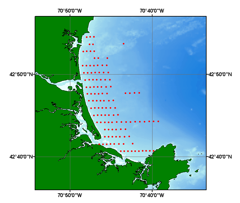
- Browse_Graphic:
-
- Browse_Graphic_File_Name: anan71.gif
- Browse_Graphic_File_Description:
-
Image map showing extent and distribution of data layer coverage.
- Browse_Graphic_File_Type: GIF
- Data_Set_Credit:
-
Please review the cross reference information for the original data set credit to Anan (1971), Polly Hastings for digitizing the sampe locations, and Larry Poppe for entering the data from the source report and creating the ArcView shapefile.
- Native_Data_Set_Environment:
-
Microsoft Windows 2000 Version 5.1 (Build 2600) ; ESRI ArcCatalog 8.2.0.700
- Cross_Reference:
-
- Citation_Information:
-
- Originator: F.S. Anan
- Publication_Date: 1971
- Title:
-
Provenance and Statistical Parameters of Sediments of the Merrimack Embayment, Gulf of Maine
- Edition: 1.0
- Series_Information:
-
- Series_Name: Doctoral Dissertation
- Issue_Identification: 377 p.
- Publication_Information:
-
- Publication_Place: Amherst, MA
- Publisher: University of Massachusetts
- Data_Quality_Information:
-
- Attribute_Accuracy:
-
- Attribute_Accuracy_Report:
-
All attributes were entered and checked by the compilers in a consistent manner.
- Logical_Consistency_Report:
-
No additional checks for topological consistency were performed on this data.
- Completeness_Report:
-
Navigation, statistical parameters, and sample identifiers are provided for 118 stations.
- Positional_Accuracy:
-
- Horizontal_Positional_Accuracy:
-
- Horizontal_Positional_Accuracy_Report:
-
Navigation was by sighting three shore-based objects with sextants. Navigational accuracy is unknown.
- Lineage:
-
- Source_Information:
-
- Source_Citation:
-
- Citation_Information:
-
- Originator: F.S. Anan
- Publication_Date: 1971
- Title:
-
Provenance and Statistical Parameters of Sediments of the Merrimack Embayment, Gulf of Maine
- Edition: 1.0
- Geospatial_Data_Presentation_Form: document
- Series_Information:
-
- Series_Name: Doctoral Dissertation
- Publication_Information:
-
- Publication_Place: Amherst, MA
- Publisher: University of Massachusetts
- Other_Citation_Details: 377 p.
- Type_of_Source_Media: paper
- Process_Step:
-
- Process_Description:
-
Stations were digitized off maps, textural data entered into digital form, and together were imported from an ASCII text file to an ArcView table. The table was later converted to an event theme and saved as the final shapefile.
- Source_Used_Citation_Abbreviation: anan71.txt
- Process_Date: 20021022
- Source_Produced_Citation_Abbreviation: anan71.shp
- Source_Produced_Citation_Abbreviation: anan71.dbf
- Source_Produced_Citation_Abbreviation: anan71.shx
- Process_Contact:
-
- Contact_Information:
-
- Contact_Person_Primary:
-
- Contact_Person: Lawrence J. Poppe
- Contact_Organization: U.S. Geological Survey
- Contact_Position: Geologist
- Contact_Address:
-
- Address_Type: mailing and physical address
- Address: 384 Woods Hole Road
- City: Woods Hole
- State_or_Province: MA
- Postal_Code: 02543-1598
- Country: USA
- Contact_Voice_Telephone: 508-548-8700 x2314
- Contact_Facsimile_Telephone: 508-457-2310
- Contact_Electronic_Mail_Address: [email protected]
- Spatial_Data_Organization_Information:
-
- Direct_Spatial_Reference_Method: Vector
- Point_and_Vector_Object_Information:
-
- SDTS_Terms_Description:
-
- SDTS_Point_and_Vector_Object_Type: Entity point
- Point_and_Vector_Object_Count: 118
- Spatial_Reference_Information:
-
- Horizontal_Coordinate_System_Definition:
-
- Geographic:
-
- Latitude_Resolution: 0.0001
- Longitude_Resolution: 0.0001
- Geographic_Coordinate_Units: Decimal degrees
- Geodetic_Model:
-
- Horizontal_Datum_Name: North American Datum of 1927
- Ellipsoid_Name: Clarke 1866
- Semi-major_Axis: 6378206.400000
- Denominator_of_Flattening_Ratio: 294.978698
- Entity_and_Attribute_Information:
-
- Detailed_Description:
-
- Entity_Type:
-
- Entity_Type_Label: anan71.dbf
- Entity_Type_Definition: Shapefile Attribute Table
- Entity_Type_Definition_Source: ESRI
- Attribute:
-
- Attribute_Label: FID
- Attribute_Definition: Internal feature number.
- Attribute_Definition_Source: ESRI
- Attribute_Domain_Values:
-
- Unrepresentable_Domain:
-
Sequential unique whole numbers that are automatically generated.
- Attribute:
-
- Attribute_Label: Shape
- Attribute_Definition: Feature geometry.
- Attribute_Definition_Source: ESRI
- Attribute_Domain_Values:
-
- Unrepresentable_Domain: Coordinates defining the features.
- Attribute:
-
- Attribute_Label: PROJECTID
- Attribute_Definition: Names assigned to dataset for identification purposes.
- Attribute_Definition_Source: Compiler
- Attribute_Domain_Values:
-
- Enumerated_Domain:
-
- Enumerated_Domain_Value: ANAN1971
- Attribute:
-
- Attribute_Label: STATION
- Attribute_Definition: Unique identifiers assigned to each station
- Attribute_Definition_Source: Scientist
- Attribute_Domain_Values:
-
- Unrepresentable_Domain: Station names
- Attribute:
-
- Attribute_Label: LONGITUDE
- Attribute_Definition: Longitude coordinate of sample location
- Attribute_Definition_Source: Scientist
- Attribute_Domain_Values:
-
- Range_Domain:
-
- Range_Domain_Minimum: 42.6779
- Range_Domain_Maximum: 42.9091
- Attribute_Units_of_Measure: Decimal Degrees
- Attribute_Measurement_Resolution: 0.0001
- Attribute:
-
- Attribute_Label: LATITUDE
- Attribute_Definition: Latitude coordinate of sample location
- Attribute_Definition_Source: Scientist
- Attribute_Domain_Values:
-
- Range_Domain:
-
- Range_Domain_Minimum: -70.8075
- Range_Domain_Maximum: -70.6540
- Attribute_Units_of_Measure: Decimal Degrees
- Attribute_Measurement_Resolution: 0.0001
- Attribute:
-
- Attribute_Label: DEVICE
- Attribute_Definition: Equipment used to collect samples
- Attribute_Definition_Source: Scientist
- Attribute_Domain_Values:
-
- Enumerated_Domain:
-
- Enumerated_Domain_Value: GRAB
- Attribute:
-
- Attribute_Label: MEAN_PHI
- Attribute_Definition: Mean determined by graphicsal statistics
- Attribute_Definition_Source: Scientist
- Attribute_Domain_Values:
-
- Range_Domain:
-
- Range_Domain_Minimum: 0.118
- Range_Domain_Maximum: 3.751
- Attribute_Units_of_Measure: phi
- Attribute_Measurement_Resolution: 0.001
- Attribute:
-
- Attribute_Label: STDDEV_PHI
- Attribute_Definition: Standard deviation determined by graphical statistics
- Attribute_Definition_Source: Scientist
- Attribute_Domain_Values:
-
- Range_Domain:
-
- Range_Domain_Minimum: 0.288
- Range_Domain_Maximum: 1.055
- Attribute_Units_of_Measure: phi
- Attribute_Measurement_Resolution: 0.001
- Attribute:
-
- Attribute_Label: SKEWNESS
- Attribute_Definition: Skewness determined by graphical statistics
- Attribute_Definition_Source: Scientist
- Attribute_Domain_Values:
-
- Range_Domain:
-
- Range_Domain_Minimum: -0.195
- Range_Domain_Maximum: 0.626
- Attribute_Measurement_Resolution: 0.001
- Attribute:
-
- Attribute_Label: KURTOSIS
- Attribute_Definition: Kurtosis (peakedness) determined by graphical statistics
- Attribute_Definition_Source: Scientist
- Attribute_Domain_Values:
-
- Range_Domain:
-
- Range_Domain_Minimum: 0.746
- Range_Domain_Maximum: 1.922
- Attribute_Measurement_Resolution: 0.001
- Attribute:
-
- Attribute_Label: LITHOLOGY
- Attribute_Definition: Textural description of the sediment
- Attribute_Definition_Source: Compiler
- Attribute_Domain_Values:
-
- Unrepresentable_Domain: Verbal descriptions of the sediment
- Distribution_Information:
-
- Distributor:
-
- Contact_Information:
-
- Contact_Person_Primary:
-
- Contact_Person: Lawrence J. Poppe
- Contact_Organization: U.S. Geological Survey
- Contact_Position: Geologist
- Contact_Address:
-
- Address_Type: mailing and physical address
- Address: 384 Woods Hole Road
- City: Woods Hole
- State_or_Province: MA
- Postal_Code: 02543-1598
- Country: USA
- Contact_Voice_Telephone: 508-548-8700 x2314
- Contact_Facsimile_Telephone: 508-457-2310
- Contact_Electronic_Mail_Address: [email protected]
- Resource_Description:
-
Regional Mapping of Surficial Sediments: Gulf of Maine and Georges Bank, Aggregates and Habitats Projects, anan71.shp
- Distribution_Liability:
-
Although this data set has been used by the U.S. Geological Survey, no warranty, expressed or implied, is made by the USGS as to the accuracy of the data and/or related materials. The act of distribution shall not constitute any such warranty, and no responsibility is assumed by the USGS in the use of these data or related materials.
- Standard_Order_Process:
-
- Digital_Form:
-
- Digital_Transfer_Information:
-
- Format_Name: ArcView shapefile
- Format_Version_Number: 3.2
- Format_Specification: ESRI point shapefile
- Format_Information_Content:
-
Five files (anan71.shp, anan71.dbf, anan71.shx, anan71.sbx, anan71.sbn) comprising the ArcView point shapefile components, 'prj' and 'avl' files, metadata text file and browse graphic.
- File_Decompression_Technique: zip
- Transfer_Size: 0.137
- Digital_Transfer_Option:
-
- Offline_Option:
-
- Offline_Media: CD-ROM
- Recording_Capacity:
-
- Recording_Density: 650
- Recording_Density_Units: Mbytes
- Compatibility_Information:
-
The user must have a computer system with a CD-ROM available. To browse the information contained on this CD-ROM, the user must have a current WWW browser available. The user must also have software installed on their computer to unzip the archived file.
- Fees: None
- Technical_Prerequisites:
-
The data is available in ArcView shapefile format. The user must have ArcView 3.0 or greater software to read and process the data file. In lieu of ArcView, the user may utilize another GIS application package capable of importing data.
- Available_Time_Period:
-
- Time_Period_Information:
-
- Single_Date/Time:
-
- Calendar_Date: 2002
- Metadata_Reference_Information:
-
- Metadata_Date: 20030216
- Metadata_Contact:
-
- Contact_Information:
-
- Contact_Person_Primary:
-
- Contact_Person: Lawrence J. Poppe
- Contact_Organization: U.S. Geological Survey
- Contact_Position: Geologist
- Contact_Address:
-
- Address_Type: mailing and physical address
- Address: 384 Woods Hole Road
- City: Woods Hole
- State_or_Province: MA
- Postal_Code: 02543-1598
- Country: USA
- Contact_Voice_Telephone: 508-548-8700 x2314
- Contact_Facsimile_Telephone: 508-457-2310
- Contact_Electronic_Mail_Address: [email protected]
- Metadata_Standard_Name: FGDC Content Standards for Digital Geospatial Metadata
- Metadata_Standard_Version: FGDC-STD-001-1998
- Metadata_Time_Convention: local time
- Metadata_Access_Constraints: None
- Metadata_Use_Constraints: None
Generated by mp version 2.7.3 on Sun Feb 16 12:15:36 2003
OFR03-001 Home | Introduction
| Nomenclature | Browse
Maps | Data Catalog | Data
Dictionary
[an error occurred while processing this directive]