|
 |
| U.S. Geological Survey
Open-File Report 03-001 |
|
|
BOCKMAN65: U.S. Naval Oceanographic Office Cores
|
Metadata also available as: FAQ - TEXT
Metadata:
- Identification_Information:
-
- Citation:
-
- Citation_Information:
-
- Originator: Lawrence J. Poppe
- Publication_Date: 2003
- Title: BOCKMAN65: U.S. Naval Oceanographic Office Cores
- Edition: 1.0
- Geospatial_Data_Presentation_Form: vector digital data
- Series_Information:
- Publication_Information:
-
- Publication_Place: Woods Hole Field Center, Woods Hole, MA
- Publisher: U. S. Geological Survey, Coastal and Marine Geology Program
- Online_Linkage:
-
<http://pubs.usgs.gov/of/2003/of03-001/data/seddata/bockman65/bockman65.zip>
- Online_Linkage:
-
<http://pubs.usgs.gov/of/2003/of03-001/data/seddata/bockman65/bockman65.zip>
- Larger_Work_Citation:
-
- Citation_Information:
-
- Originator: L.J. Poppe
- Originator: V.F. Paskevich
- Originator: S.J. Williams
- Originator: M.E. Hastings
- Originator: J.T. Kelley
- Originator: D.F. Belknap
- Originator: L.G. Ward
- Originator: D.M. FitzGerald
- Originator: P.F. Larsen
- Publication_Date: 2003
- Title:
-
Surficial Sediment Data from the Gulf of Maine, Georges Bank, and vicinity: a GIS Compilation
- Edition: 1.0
- Series_Information:
-
- Series_Name: Open-File Report
- Issue_Identification: 03-001
- Publication_Information:
-
- Publication_Place: Woods Hole Field Center, Woods Hole, MA
- Publisher: U. S. Geological Survey, Coastal and Marine Geology Program
- Other_Citation_Details:
-
Data is released via CD-ROM media. This digital publication may also be available via the web at pubs.usgs.gov
- Online_Linkage: <http://pubs.usgs.gov/of/2003/of03-001>
- Online_Linkage: <http://pubs.usgs.gov/of/2003/of03-001>
- Description:
-
- Abstract:
-
The results of the sediment size analysis performed by the U.S.Naval Oceanographic Office Geological Laboratory for six Phleger gravity cores are presented in this data layer. Some of the data in this set were originally released as part of the Deck 41 Database available from the National Geophysical Data Center. The attribute for sediment classification was added by the compilers to make these size data more useful for mapping the regional surficial sediment distribution.
- Purpose:
-
The purpose of this data layer is to release a digital version of the sediment data contained in the unpublished report by Bockman et al. (1965)
- Time_Period_of_Content:
-
- Time_Period_Information:
-
- Single_Date/Time:
-
- Calendar_Date: 1965
- Currentness_Reference: publication date
- Status:
-
- Progress: Complete
- Maintenance_and_Update_Frequency: None planned
- Spatial_Domain:
-
- Bounding_Coordinates:
-
- West_Bounding_Coordinate: -71.208333
- East_Bounding_Coordinate: -71.083333
- North_Bounding_Coordinate: 40.083333
- South_Bounding_Coordinate: 39.975000
- Keywords:
-
- Theme:
-
- Theme_Keyword_Thesaurus: General
- Theme_Keyword: U.S. Geological Survey
- Theme_Keyword: USGS
- Theme_Keyword: Woods Hole Field Center
- Theme_Keyword: Coastal and Marine Geology Program
- Theme_Keyword: cores
- Theme_Keyword: Phleger Gravity Cores
- Theme_Keyword: sediment
- Theme_Keyword: texture
- Theme_Keyword: grain size
- Theme_Keyword: gravel
- Theme_Keyword: sand
- Theme_Keyword: silt
- Theme_Keyword: clay
- Theme_Keyword: statistics
- Theme_Keyword: sediment classification
- Theme_Keyword: Open-File Report 03-001
- Theme_Keyword: CMGP
- Theme_Keyword: surficial classification
- Theme_Keyword: ArcView shapefile
- Theme_Keyword: points
- Theme_Keyword: Geographic Information System
- Theme_Keyword: GIS
- Place:
-
- Place_Keyword_Thesaurus: General
- Place_Keyword: U.S. East Coast
- Place_Keyword: Atlantic
- Place_Keyword: Continental Shelf
- Place_Keyword: Shelf
- Access_Constraints: None
- Use_Constraints: None
- Point_of_Contact:
-
- Contact_Information:
-
- Contact_Person_Primary:
-
- Contact_Person: Lawrence J. Poppe
- Contact_Organization: U.S. Geological Survey
- Contact_Position: Geologist
- Contact_Address:
-
- Address_Type: mailing and physical address
- Address: 384 Woods Hole Road
- City: Woods Hole
- State_or_Province: MA
- Postal_Code: 02543-1598
- Country: USA
- Contact_Voice_Telephone: 508-548-8700 x2314
- Contact_Facsimile_Telephone: 508-457-2310
- Contact_Electronic_Mail_Address: lpoppe@usgs.gov
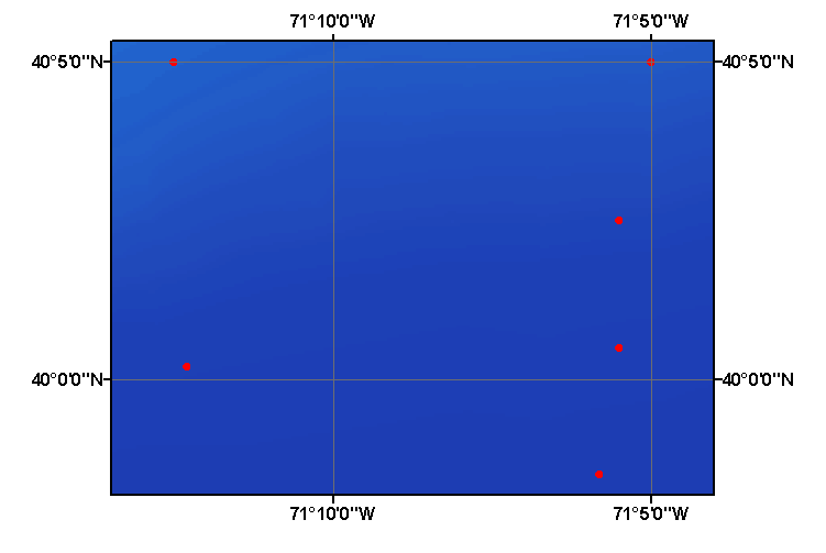
- Browse_Graphic:
-
- Browse_Graphic_File_Name: bockman65
- Browse_Graphic_File_Description:
-
Image map showing extent and distribution of data layer coverage.
- Browse_Graphic_File_Type: GIF
- Data_Set_Credit:
-
Please review the cross reference information for the original data set credit to Bockman et al. (1965), and Larry Poppe for generating the sediment classifications and creating the ArcView shapefile.
- Native_Data_Set_Environment:
-
Microsoft Windows 2000 Version 5.1 (Build 2600) ; ESRI ArcCatalog 8.2.0.700
- Cross_Reference:
-
- Citation_Information:
-
- Originator: P. Bockman
- Originator: J. Celeman
- Originator: D.S. Hill
- Publication_Date: 1965
- Title:
-
A Summary of Sediment Size and Composition Analyses of Cores from NLON Survey, March 1965
- Series_Information:
-
- Series_Name: U.S. Naval Oceanographic Office Geological Laboratory Report
- Issue_Identification: Laboratory Item No. 251
- Publication_Information:
-
- Publication_Place: Washington, DC
- Publisher: U.S. Naval Oceanographic Data Center
- Data_Quality_Information:
-
- Attribute_Accuracy:
-
- Attribute_Accuracy_Report:
-
All attributes were imported (or generated and entered) and checked by the compilers in a consistent manner.
- Logical_Consistency_Report:
-
No additional checks for topological consistency were performed on this data.
- Completeness_Report:
-
Grain-size data, statistics, sediment color, carbonate composition, textural descriptions, navigation, and sample identifiers are provided for 6 stations.
- Positional_Accuracy:
-
- Horizontal_Positional_Accuracy:
-
- Horizontal_Positional_Accuracy_Report:
-
Navigational methods were not discussed in the original report. Navigational accuracy is unknown.
- Lineage:
-
- Source_Information:
-
- Source_Citation:
-
- Citation_Information:
-
- Originator: P. Bockman
- Originator: J. Coleman
- Originator: D.S. Hill
- Publication_Date: 1965
- Title:
-
A Summary of Sediment Size and Composition Analyses of Cores from NLON Survey, March 1965
- Edition: 1.0
- Series_Information:
-
- Series_Name: U.S. Naval Oceanographic Office Geological Laboratory Report
- Issue_Identification: Laboratory Item No. 251
- Publication_Information:
-
- Publication_Place: Washington, DC
- Publisher: U.S. Naval Oceanographic Data Center
- Type_of_Source_Media: online
- Source_Time_Period_of_Content:
-
- Time_Period_Information:
-
- Single_Date/Time:
-
- Calendar_Date: 1965
- Source_Currentness_Reference: publication date
- Process_Step:
-
- Process_Description:
-
Some of the source information was taken from NGDC's Deck41 database (e.g. identifiers and raw grain size data); some information generated by the compilers and was manually entered into digital form (e.g. classification). This file was imported from an ASCII text file to an ArcView table. The table was later converted to an event theme in ArcView and saved as the final shapefile.
- Source_Used_Citation_Abbreviation: bockman65.txt
- Process_Date: 20020920
- Source_Produced_Citation_Abbreviation: bockman65.shp
- Source_Produced_Citation_Abbreviation: bockman65.dbf
- Source_Produced_Citation_Abbreviation: bockman65.shx
- Process_Contact:
-
- Contact_Information:
-
- Contact_Person_Primary:
-
- Contact_Person: Lawrence J. Poppe
- Contact_Organization: U.S. Geological Survey
- Contact_Position: Geologist
- Contact_Address:
-
- Address_Type: mailing and physical address
- Address: 384 Woods Hole Road
- City: Woods Hole
- State_or_Province: MA
- Postal_Code: 02543-1598
- Country: USA
- Contact_Voice_Telephone: 508-548-8700 x2314
- Contact_Facsimile_Telephone: 508-457-2310
- Contact_Electronic_Mail_Address: lpoppe@usgs.gov
- Spatial_Data_Organization_Information:
-
- Direct_Spatial_Reference_Method: Vector
- Point_and_Vector_Object_Information:
-
- SDTS_Terms_Description:
-
- SDTS_Point_and_Vector_Object_Type: Entity point
- Point_and_Vector_Object_Count: 6
- Spatial_Reference_Information:
-
- Horizontal_Coordinate_System_Definition:
-
- Geographic:
-
- Latitude_Resolution: 0.00001
- Longitude_Resolution: 0.00001
- Geographic_Coordinate_Units: Decimal degrees
- Geodetic_Model:
-
- Horizontal_Datum_Name: North American Datum of 1927
- Ellipsoid_Name: Clarke 1866
- Semi-major_Axis: 6378206.400000
- Denominator_of_Flattening_Ratio: 294.978698
- Entity_and_Attribute_Information:
-
- Detailed_Description:
-
- Entity_Type:
-
- Entity_Type_Label: bockman65.dbf
- Entity_Type_Definition: Shapefile Attribute Table
- Entity_Type_Definition_Source: ESRI
- Attribute:
-
- Attribute_Label: FID
- Attribute_Definition: Internal feature number.
- Attribute_Definition_Source: ESRI
- Attribute_Domain_Values:
-
- Unrepresentable_Domain:
-
Sequential unique whole numbers that are automatically generated.
- Attribute:
-
- Attribute_Label: Shape
- Attribute_Definition: Feature geometry.
- Attribute_Definition_Source: ESRI
- Attribute_Domain_Values:
-
- Unrepresentable_Domain: Coordinates defining the features.
- Attribute:
-
- Attribute_Label: PROJECTID
- Attribute_Definition: Names assigned to the data set for identification purposes
- Attribute_Definition_Source: Compiler
- Attribute_Domain_Values:
-
- Enumerated_Domain:
-
- Enumerated_Domain_Value: Bockman65
- Attribute:
-
- Attribute_Label: CRUISEID
- Attribute_Definition: Name of ship and abbreviation of survey
- Attribute_Definition_Source: Scientist
- Attribute_Domain_Values:
-
- Enumerated_Domain:
-
- Enumerated_Domain_Value: NLONSU
- Enumerated_Domain_Value_Definition: NLON Survey
- Attribute:
-
- Attribute_Label: STATION
- Attribute_Definition: Numeric identifier assigned to each sampling station
- Attribute_Definition_Source: Scientist
- Attribute_Domain_Values:
-
- Range_Domain:
-
- Range_Domain_Minimum: 1
- Range_Domain_Maximum: 6
- Attribute_Units_of_Measure: integer count
- Attribute_Measurement_Resolution: 1
- Attribute:
-
- Attribute_Label: LATITUDE
- Attribute_Definition: Latitude coordinate of sample location
- Attribute_Definition_Source: Scientist
- Attribute_Domain_Values:
-
- Range_Domain:
-
- Range_Domain_Minimum: 39.97500
- Range_Domain_Maximum: 40.08333
- Attribute_Units_of_Measure: Decimal Degrees
- Attribute_Measurement_Resolution: 0.00001
- Attribute:
-
- Attribute_Label: LONGITUDE
- Attribute_Definition: Longitude coordinate of sample location
- Attribute_Definition_Source: Scientis
- Attribute_Domain_Values:
-
- Range_Domain:
-
- Range_Domain_Minimum: -71.20833
- Range_Domain_Maximum: -71.08333
- Attribute_Units_of_Measure: Decimal Degrees
- Attribute_Measurement_Resolution: 0.00001
- Attribute:
-
- Attribute_Label: DEPTH
- Attribute_Definition: Water depth
- Attribute_Definition_Source: Scientist
- Attribute_Domain_Values:
-
- Range_Domain:
-
- Range_Domain_Minimum: 160
- Range_Domain_Maximum: 370
- Attribute_Units_of_Measure: meters
- Attribute_Measurement_Resolution: 1
- Attribute:
-
- Attribute_Label: DATE
- Attribute_Definition: Day month and year (ddmmyy) of sample collection
- Attribute_Definition_Source: Scientist
- Attribute_Domain_Values:
-
- Unrepresentable_Domain: Character string containing date in DDMMYY format
- Attribute:
-
- Attribute_Label: DEVICE
- Attribute_Definition: Equipment used to collect samples
- Attribute_Definition_Source: Scientist
- Attribute_Domain_Values:
-
- Enumerated_Domain:
-
- Enumerated_Domain_Value: PHLEGER GRAVITY CORER
- Enumerated_Domain_Value_Definition: Phleger Gravity Corer
- Enumerated_Domain_Value_Definition_Source: Scientist
- Attribute:
-
- Attribute_Label: GRAVEL
- Attribute_Definition: Percentage of gravel in sample
- Attribute_Definition_Source: Scientist
- Attribute_Domain_Values:
-
- Range_Domain:
-
- Range_Domain_Minimum: 0
- Range_Domain_Maximum: 0.39
- Attribute_Units_of_Measure: percent
- Attribute_Measurement_Resolution: 0.01
- Attribute:
-
- Attribute_Label: SAND
- Attribute_Definition: Percentage of sand in sample
- Attribute_Definition_Source: Scientist
- Attribute_Domain_Values:
-
- Range_Domain:
-
- Range_Domain_Minimum: 30.72
- Range_Domain_Maximum: 72.83
- Attribute_Units_of_Measure: percent
- Attribute_Measurement_Resolution: 0.01
- Attribute:
-
- Attribute_Label: SILT
- Attribute_Definition: Percentage of silt in sample
- Attribute_Definition_Source: Scientist
- Attribute_Domain_Values:
-
- Range_Domain:
-
- Range_Domain_Minimum: 15.68
- Range_Domain_Maximum: 54.72
- Attribute_Units_of_Measure: percent
- Attribute_Measurement_Resolution: 0.01
- Attribute:
-
- Attribute_Label: CLAY
- Attribute_Definition: Percentage of clay in sample
- Attribute_Definition_Source: Scientist
- Attribute_Domain_Values:
-
- Range_Domain:
-
- Range_Domain_Minimum: 6.87
- Range_Domain_Maximum: 15.45
- Attribute_Units_of_Measure: percent
- Attribute_Measurement_Resolution: 0.01
- Attribute:
-
- Attribute_Label: CLASS
- Attribute_Definition:
-
Textural classification based on a scheme devised by Shepard (1954)
- Attribute_Definition_Source: Compiler
- Attribute_Domain_Values:
-
- Enumerated_Domain:
-
- Enumerated_Domain_Value: SAND
- Enumerated_Domain_Value_Definition: sand content
- Enumerated_Domain_Value_Definition_Source: Visual examination of sample by scientist
- Enumerated_Domain:
-
- Enumerated_Domain_Value: SILTY SAND
- Enumerated_Domain_Value_Definition: silty sand content
- Enumerated_Domain_Value_Definition_Source: Visual examination of sample by scientist
- Enumerated_Domain:
-
- Enumerated_Domain_Value: SANDY SILT
- Enumerated_Domain_Value_Definition: sandy silt content
- Enumerated_Domain_Value_Definition_Source: Visual examination of sample by scientist
- Attribute:
-
- Attribute_Label: MEAN_PHI_
- Attribute_Definition: Average grain size in phi units
- Attribute_Definition_Source: Scientist
- Attribute_Domain_Values:
-
- Range_Domain:
-
- Range_Domain_Minimum: 3.53
- Range_Domain_Maximum: 5.53
- Attribute_Units_of_Measure: phi
- Attribute_Measurement_Resolution: 0.01
- Attribute:
-
- Attribute_Label: STDEV
- Attribute_Definition: Standard deviation of the grain size distribution
- Attribute_Definition_Source: Scientist
- Attribute_Domain_Values:
-
- Range_Domain:
-
- Range_Domain_Minimum: 2.61
- Range_Domain_Maximum: 3.17
- Attribute_Units_of_Measure: phi
- Attribute_Measurement_Resolution: 0.01
- Attribute:
-
- Attribute_Label: SKEWNESS
- Attribute_Definition: Skewness of grain size distribution
- Attribute_Definition_Source: Scientist
- Attribute_Domain_Values:
-
- Range_Domain:
-
- Range_Domain_Minimum: 0.39
- Range_Domain_Maximum: 0.76
- Attribute_Units_of_Measure: none
- Attribute_Measurement_Resolution: 0.01
- Attribute:
-
- Attribute_Label: KURTOSIS
- Attribute_Definition: Peakedness of size distribution
- Attribute_Definition_Source: Scientist
- Attribute_Domain_Values:
-
- Range_Domain:
-
- Range_Domain_Minimum: -0.21
- Range_Domain_Maximum: 1.86
- Attribute_Measurement_Resolution: 0.01
- Attribute:
-
- Attribute_Label: CACO3
- Attribute_Definition:
-
Percentage of carbonate in sample determined by insoluble residue
- Attribute_Definition_Source: Scientist
- Attribute_Domain_Values:
-
- Range_Domain:
-
- Range_Domain_Minimum: 8
- Range_Domain_Maximum: 15
- Attribute_Units_of_Measure: percent
- Attribute_Measurement_Resolution: 1
- Attribute:
-
- Attribute_Label: COLOR
- Attribute_Definition: Wet sediment color based on the GSA Rock Color Chart
- Attribute_Definition_Source: Scientist
- Attribute_Domain_Values:
-
- Unrepresentable_Domain: Character String; Characters and numbers designating color
- Distribution_Information:
-
- Distributor:
-
- Contact_Information:
-
- Contact_Person_Primary:
-
- Contact_Person: Lawrence J. Poppe
- Contact_Organization: U.S. Geological Survey
- Contact_Position: Geologist
- Contact_Address:
-
- Address_Type: mailing and physical address
- Address: 384 Woods Hole Road
- City: Woods Hole
- State_or_Province: MA
- Postal_Code: 02543-1598
- Country: USA
- Contact_Voice_Telephone: 508-548-8700 x2314
- Contact_Facsimile_Telephone: 508-457-2310
- Contact_Electronic_Mail_Address: lpoppe@usgs.gov
- Resource_Description:
-
Regional Mapping of Surficial Sediments: Gulf of Maine and Georges Bank, Aggregates and Habitats Projects, bockman65.shp
- Distribution_Liability:
-
Although this data set has been used by the U.S. Geological Survey, no warranty, expressed or implied, is made by the USGS as to the accuracy of the data and/or related materials. The act of distribution shall not constitute any such warranty, and no responsibility is assumed by the USGS in the use of these data or related materials.
- Standard_Order_Process:
-
- Digital_Form:
-
- Digital_Transfer_Information:
-
- Format_Name: ArcView shapefile
- Format_Version_Number: 3.2
- Format_Specification: ESRI point shapefile
- Format_Information_Content:
-
Five files (bockman65.shp, bockman65.dbf, bockman65.shx, bockman65.sbx, bockman65.sbn) comprising the ArcView point shapefile components, 'prj' and 'avl' files, metadata text file and browse graphic.
- File_Decompression_Technique: zip
- Transfer_Size: 0.130
- Digital_Transfer_Option:
-
- Offline_Option:
-
- Offline_Media: CD-ROM
- Recording_Capacity:
-
- Recording_Density: 650
- Recording_Density_Units: Mbytes
- Compatibility_Information:
-
The user must have a computer system with a CD-ROM available. To browse the information contained on this CD-ROM, the user must have a current WWW browser available. The user must also have software installed on their computer to unzip the archived file.
- Fees: None
- Technical_Prerequisites:
-
The data is available in ArcView shapefile format. The user must have ArcView 3.0 or greater software to read and process the data file. In lieu of ArcView, the user may utilize another GIS application package capable of importing data.
- Available_Time_Period:
-
- Time_Period_Information:
-
- Single_Date/Time:
-
- Calendar_Date: 2002
- Metadata_Reference_Information:
-
- Metadata_Date: 20030321
- Metadata_Contact:
-
- Contact_Information:
-
- Contact_Person_Primary:
-
- Contact_Person: Lawrence J. Poppe
- Contact_Organization: U.S. Geological Survey
- Contact_Position: Geologist
- Contact_Address:
-
- Address_Type: mailing and physical address
- Address: 384 Woods Hole Road
- City: Woods Hole
- State_or_Province: MA
- Postal_Code: 02543-1598
- Country: USA
- Contact_Voice_Telephone: 508-548-8700 x2314
- Contact_Facsimile_Telephone: 508-457-2310
- Contact_Electronic_Mail_Address: lpoppe@usgs.gov
- Metadata_Standard_Name: FGDC Content Standards for Digital Geospatial Metadata
- Metadata_Standard_Version: FGDC-STD-001-1998
- Metadata_Time_Convention: local time
- Metadata_Access_Constraints: None
- Metadata_Use_Constraints: None
Generated by mp version 2.7.3 on Fri Mar 21 11:15:34 2003
OFR03-001 Home | Introduction
| Nomenclature | Browse
Maps | Data Catalog | Data
Dictionary
[an error occurred while processing this directive]