|
 |
| U.S. Geological Survey
Open-File Report 03-001 |
|
|
HATHLITH71: Lithologic Descriptions from the Continental Margin Program
|
Metadata also available as: FAQ - TEXT
Metadata:
- Identification_Information:
-
- Citation:
-
- Citation_Information:
-
- Originator: Lawrence J. Poppe
- Publication_Date: 2003
- Title:
-
HATHLITH71: Lithologic Descriptions from the Continental Margin Program
- Edition: 1.0
- Geospatial_Data_Presentation_Form: vector digital data
- Series_Information:
- Publication_Information:
-
- Publication_Place: Woods Hole Field Center, Woods Hole, MA
- Publisher: U. S. Geological Survey, Coastal and Marine Geology Program
- Online_Linkage:
-
<http://pubs.usgs.gov/of/2003/of03-001/data/seddata/hathlith71/hathlith71.zip>
- Online_Linkage:
-
<http://pubs.usgs.gov/of/2003/of03-001/data/seddata/hathlith71/hathlith71.zip>
- Larger_Work_Citation:
-
- Citation_Information:
-
- Originator: L.J. Poppe
- Originator: V.F. Paskevich
- Originator: S.J. Williams
- Originator: M.E. Hastings
- Originator: J.T. Kelley
- Originator: D.F. Belknap
- Originator: L.G. Ward
- Originator: D.M. FitzGerald
- Originator: P.F. Larsen
- Publication_Date: 2003
- Title:
-
Surficial Sediment Data from the Gulf of Maine, Georges Bank, and vicinity: a GIS Compilation
- Edition: 1.0
- Geospatial_Data_Presentation_Form: vector digital data
- Series_Information:
-
- Series_Name: Open-File Report
- Issue_Identification: 03-001
- Publication_Information:
-
- Publication_Place: Woods Hole Field Center, Woods Hole, MA
- Publisher: U. S. Geological Survey, Coastal and Marine Geology Program
- Other_Citation_Details:
-
Data is released via CD-ROM media. This digital publication may also be available via the web at pubs.usgs.gov
- Online_Linkage: <http://pubs.usgs.gov/of/2003/of03-001>
- Online_Linkage: <http://pubs.usgs.gov/of/2003/of03-001>
- Description:
-
- Abstract:
-
This data set contains lithologic information on bottom sediments from the Continental Margin Program. The program was a joint collaboration between the U.S. Geological Survey and the Woods Hole Oceanographic Institution during the 1960s to conduct a geological reconnaissance investigation of the continental shelf and slope off the Atlantic coast of the United States. Only those records without complete size analyses and only those stations from the Gulf of Maine, Georges Bank, and southeastern New England shelf and slope are included in this data set. Other stations where detailed textural analyses are available or are from other areas have been excluded. Furthermore, dredges were used to collect most of the bottom samples, resulting in winnowing that has resulted in lithologic descriptions that are texturally coarser than actually present. Care should be taken when using this dataset.
- Purpose:
-
The purpose of this data layer is to make available a digital subset of the Hathaway data set. This subset contains information for those samples with lithologic descriptions, but no raw grain size data, and which are located in/on the Gulf of Maine, Georges Bank, and southeastern New England continental shelf.
- Time_Period_of_Content:
-
- Time_Period_Information:
-
- Single_Date/Time:
-
- Calendar_Date: 1971
- Currentness_Reference: publication date
- Status:
-
- Progress: Complete
- Maintenance_and_Update_Frequency: None planned
- Spatial_Domain:
-
- Bounding_Coordinates:
-
- West_Bounding_Coordinate: -71.900000
- East_Bounding_Coordinate: -63.533330
- North_Bounding_Coordinate: 46.086670
- South_Bounding_Coordinate: 39.236670
- Keywords:
-
- Theme:
-
- Theme_Keyword_Thesaurus: General
- Theme_Keyword: U.S. Geological Survey
- Theme_Keyword: USGS
- Theme_Keyword: Coastal and Marine Geology Program
- Theme_Keyword: Woods Hole Field Center
- Theme_Keyword: lthology
- Theme_Keyword: sediment
- Theme_Keyword: texture
- Theme_Keyword: Continental Margin Program
- Theme_Keyword: Open-File Report 03-001
- Theme_Keyword: CMGP
- Theme_Keyword: sediment classification
- Theme_Keyword: surficial classification
- Theme_Keyword: ArcView shapefile
- Theme_Keyword: points
- Theme_Keyword: GIS
- Theme_Keyword: Geographic Information System
- Place:
-
- Place_Keyword_Thesaurus: General
- Place_Keyword: U.S. East Coast
- Place_Keyword: Atlantic
- Place_Keyword: continental shelf
- Place_Keyword: continental slope
- Place_Keyword: Georges Bank
- Place_Keyword: Gulf of Maine
- Place_Keyword: New England
- Access_Constraints: None
- Use_Constraints: None
- Point_of_Contact:
-
- Contact_Information:
-
- Contact_Person_Primary:
-
- Contact_Person: Lawrence J. Poppe
- Contact_Organization: U.S. Geological Survey
- Contact_Position: Geologist
- Contact_Address:
-
- Address_Type: mailing and physical address
- Address: 384 Woods Hole Road
- City: Woods Hole
- State_or_Province: MA
- Postal_Code: 02543-1598
- Country: USA
- Contact_Voice_Telephone: 508-548-8700 x2314
- Contact_Facsimile_Telephone: 508-457-2310
- Contact_Electronic_Mail_Address: [email protected]
- Browse_Graphic:
-
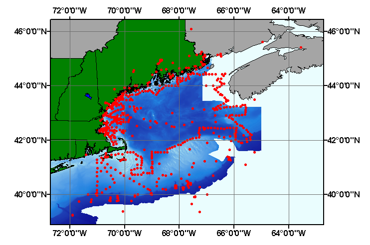
- Browse_Graphic_File_Name: hathlith71.gif
- Browse_Graphic_File_Description:
-
Image map showing extent and distribution of data layer coverage.
- Browse_Graphic_File_Type: GIF
- Data_Set_Credit:
-
Please review the cross reference information for the original data set credit to Hathaway (1971), and Larry Poppe for creating the ArcView shapefile.
- Native_Data_Set_Environment:
-
Microsoft Windows 2000 Version 5.1 (Build 2600) ; ESRI ArcCatalog 8.2.0.700
- Cross_Reference:
-
- Citation_Information:
-
- Originator: J.C. Hathaway
- Publication_Date: 1971
- Title:
-
Data File: Continental Margin Program Atlantic Coast of the United States
- Edition: 1.0
- Series_Information:
-
- Series_Name: Woods Hole Oceanographic Institution Reference
- Issue_Identification: Number 71-15, v. 2, 496 p.
- Publication_Information:
-
- Publication_Place: Woods Hole, MA
- Publisher: Woods Hole Oceanographc Institution
- Data_Quality_Information:
-
- Attribute_Accuracy:
-
- Attribute_Accuracy_Report:
-
All attributes were checked by the compilers in a consistent manner.
- Logical_Consistency_Report:
-
No additional checks for topological consistency were performed on this data.
- Completeness_Report:
-
Navigation, lithologic descriptions, and identifiers are provided for 899 stations from the Continental Margin Program
- Positional_Accuracy:
-
- Horizontal_Positional_Accuracy:
-
- Horizontal_Positional_Accuracy_Report:
-
Navigation was variously performed RADAR, Loran A, and line of sight. Navigational accuracy is unknown.
- Lineage:
-
- Source_Information:
-
- Source_Citation:
-
- Citation_Information:
-
- Originator: J.C. Hathaway
- Publication_Date: 1971
- Title:
-
Data File: Continental Margin Program Atlantic Coast of the United States
- Edition: 1.0
- Series_Information:
-
- Series_Name: Woods Hole Oceanographic Institution Reference
- Issue_Identification: Number 71-15, v. 2, 496 p.
- Publication_Information:
-
- Publication_Place: Woods Hole, MA
- Publisher: Woods Hole Oceanographic Institution
- Type_of_Source_Media: paper
- Process_Step:
-
- Process_Description:
-
Continental Margin Program data comprised of lithologic descriptions from Gulf of Maine, Georges Bank, and the continental shelf and slope off southeastern New England were clipped from the whole dataset of the Continental Margin Program in Excel and exported to an ASCII file. Stations and sediment data were imported from the ASCII text file to an ArcView table. The table was later converted to an event theme and saved as the final shapefile.
- Source_Used_Citation_Abbreviation: hathlith71.txt
- Process_Date: 20021008
- Source_Produced_Citation_Abbreviation: hathlith71.shp
- Source_Produced_Citation_Abbreviation: hathlith71.dbf
- Source_Produced_Citation_Abbreviation: hathlith71.shx
- Process_Contact:
-
- Contact_Information:
-
- Contact_Person_Primary:
-
- Contact_Person: Lawrence J.Poppe
- Contact_Organization: U.S. Geological Survey
- Contact_Position: Geologist
- Contact_Address:
-
- Address_Type: mailing and physical address
- Address: 384 Woods Hole Road
- City: Woods Hole
- State_or_Province: MA
- Postal_Code: 02543-1598
- Country: USA
- Contact_Voice_Telephone: 508-548-8700 x2314
- Contact_Facsimile_Telephone: 508-457-2310
- Contact_Electronic_Mail_Address: [email protected]
- Spatial_Data_Organization_Information:
-
- Direct_Spatial_Reference_Method: Vector
- Point_and_Vector_Object_Information:
-
- SDTS_Terms_Description:
-
- SDTS_Point_and_Vector_Object_Type: Entity point
- Point_and_Vector_Object_Count: 899
- Spatial_Reference_Information:
-
- Horizontal_Coordinate_System_Definition:
-
- Geographic:
-
- Latitude_Resolution: 0.00001
- Longitude_Resolution: 0.00001
- Geographic_Coordinate_Units: Decimal degrees
- Geodetic_Model:
-
- Horizontal_Datum_Name: North American Datum of 1927
- Ellipsoid_Name: Clarke 1866
- Semi-major_Axis: 6378206.400000
- Denominator_of_Flattening_Ratio: 294.978698
- Entity_and_Attribute_Information:
-
- Detailed_Description:
-
- Entity_Type:
-
- Entity_Type_Label: hathlith71.dbf
- Entity_Type_Definition: Shapefile Attribute Table
- Entity_Type_Definition_Source: ESRI
- Attribute:
-
- Attribute_Label: FID
- Attribute_Definition: Internal feature number.
- Attribute_Definition_Source: ESRI
- Attribute_Domain_Values:
-
- Unrepresentable_Domain:
-
Sequential unique whole numbers that are automatically generated.
- Attribute:
-
- Attribute_Label: Shape
- Attribute_Definition: Feature geometry.
- Attribute_Definition_Source: ESRI
- Attribute_Domain_Values:
-
- Unrepresentable_Domain: Coordinates defining the features.
- Attribute:
-
- Attribute_Label: FIELDID
- Attribute_Definition: Name assigned to a sampling station
- Attribute_Definition_Source: Scientist
- Attribute_Domain_Values:
-
- Unrepresentable_Domain: Character and numeric names assigned to identify a station
- Attribute:
-
- Attribute_Label: CRUISEID
- Attribute_Definition: Name assigned to identify a cruise
- Attribute_Definition_Source: Scientist
- Attribute_Domain_Values:
-
- Unrepresentable_Domain: Character and numeric names assigned to identify a ship and leg
- Attribute:
-
- Attribute_Label: AREA
- Attribute_Definition: Geographic area where the station is located
- Attribute_Definition_Source: Scientist
- Attribute_Domain_Values:
-
- Unrepresentable_Domain: Geographic area where a station is located
- Attribute:
-
- Attribute_Label: LATITUDE
- Attribute_Definition: Latitude coordinate of sample location
- Attribute_Definition_Source: Scientist
- Attribute_Domain_Values:
-
- Range_Domain:
-
- Range_Domain_Minimum: 39.23667
- Range_Domain_Maximum: 46.08667
- Attribute_Units_of_Measure: Decimal degrees
- Attribute_Measurement_Resolution: 0.00001
- Attribute:
-
- Attribute_Label: LONGITUDE
- Attribute_Definition: Longitude coordinate of sample location
- Attribute_Definition_Source: Scientist
- Attribute_Domain_Values:
-
- Range_Domain:
-
- Range_Domain_Minimum: -71.90000
- Range_Domain_Maximum: -63.53333
- Attribute_Units_of_Measure: Decimal degrees
- Attribute_Measurement_Resolution: 0.00001
- Attribute:
-
- Attribute_Label: DEPTH_M
- Attribute_Definition: Water depth in meters
- Attribute_Definition_Source: Scientist
- Attribute_Domain_Values:
-
- Range_Domain:
-
- Range_Domain_Minimum: 5
- Range_Domain_Maximum: 3423
- Attribute_Units_of_Measure: meters
- Attribute_Measurement_Resolution: 1
- Attribute:
-
- Attribute_Label: DEVICE
- Attribute_Definition: Equipment used to collect a sample
- Attribute_Definition_Source: Scientist
- Attribute_Domain_Values:
-
- Unrepresentable_Domain: Name of equipment used to collect a sample
- Attribute:
-
- Attribute_Label: DATE
- Attribute_Definition: Year sample was collected
- Attribute_Definition_Source: Scientist
- Attribute_Domain_Values:
-
- Range_Domain:
-
- Range_Domain_Minimum: 1955
- Range_Domain_Maximum: 1970
- Attribute_Units_of_Measure: year
- Attribute_Measurement_Resolution: 1
- Attribute:
-
- Attribute_Label: LITHOLOGY
- Attribute_Definition: Description of the sediment
- Attribute_Definition_Source: Scientist
- Attribute_Domain_Values:
-
- Unrepresentable_Domain: Verbal description of the sediments character
- Attribute:
-
- Attribute_Label: COMMENTS
- Attribute_Definition: Notes on sampling and bottom character
- Attribute_Definition_Source: Scientist
- Attribute_Domain_Values:
-
- Unrepresentable_Domain: Notes on sampling and bottom character
- Attribute:
-
- Attribute_Label: CLASSIFICA
- Attribute_Definition:
-
Textural description of the sediment. Most samples collected by dredge have been excluded
- Attribute_Definition_Source: Compiler
- Attribute_Domain_Values:
-
- Unrepresentable_Domain: Verbal descriptions of the sediment and(or) bottom
- Overview_Description:
-
- Entity_and_Attribute_Overview:
-
Navigation, lithologic description, and station identifiers for samples from a subset of those collected as part of the Continental Margin Program.
- Distribution_Information:
-
- Distributor:
-
- Contact_Information:
-
- Contact_Person_Primary:
-
- Contact_Person: Lawrence J. Poppe
- Contact_Organization: U.S. Geological Survey
- Contact_Position: Geologist
- Contact_Address:
-
- Address_Type: mailing and physical address
- Address: 384 Woods Hole Road
- City: Woods Hole
- State_or_Province: MA
- Postal_Code: 02543-1598
- Country: USA
- Contact_Voice_Telephone: 508-548-8700 x2314
- Contact_Facsimile_Telephone: 508-457-2310
- Contact_Electronic_Mail_Address: [email protected]
- Resource_Description:
-
Regional Mapping of Surficial Sediments: Gulf of Maine and Georges Bank, Aggregates and Habitats Projects, hathlith71.shp
- Distribution_Liability:
-
Although this data set has been used by the U.S. Geological Survey, no warranty, expressed or implied, is made by the USGS as to the accuracy of the data and/or related materials. The act of distribution shall not constitute any such warranty, and no responsibility is assumed by the USGS in the use of these data or related materials.
- Standard_Order_Process:
-
- Digital_Form:
-
- Digital_Transfer_Information:
-
- Format_Name: ArcView shapefile
- Format_Version_Number: 3.2
- Format_Specification: ESRI point shapefile
- Format_Information_Content:
-
Five files (hathlith71.shp, hathlith71.dbf, hathlith71.shx, hathlith71.sbx, hathlith71.sbn) comprising the ArcView point shapefile components, 'prj' and 'avl' files, metadata text file and browse graphic.
- File_Decompression_Technique: zip
- Transfer_Size: 0.394
- Digital_Transfer_Option:
-
- Offline_Option:
-
- Offline_Media: CD-ROM
- Recording_Capacity:
-
- Recording_Density: 650
- Recording_Density_Units: Mbytes
- Compatibility_Information:
-
The user must have a computer system with a CD-ROM available. To browse the information contained on this CD-ROM, the user must have a current WWW browser available. The user must also have software installed on their computer to unzip the archived file.
- Fees: None
- Technical_Prerequisites:
-
The data is available in ArcView shapefile format. The user must have ArcView 3.0 or greater software to read and process the data file. In lieu of ArcView, the user may utilize another GIS application package capable of importing data.
- Available_Time_Period:
-
- Time_Period_Information:
-
- Single_Date/Time:
-
- Calendar_Date: 2002
- Metadata_Reference_Information:
-
- Metadata_Date: 20030216
- Metadata_Contact:
-
- Contact_Information:
-
- Contact_Person_Primary:
-
- Contact_Person: Lawrence J. Poppe
- Contact_Organization: U.S. Geological Survey
- Contact_Position: Geologist
- Contact_Address:
-
- Address_Type: mailing and physical address
- Address: 384 Woods Hole Road
- City: Woods Hole
- State_or_Province: MA
- Postal_Code: 02543-1598
- Country: USA
- Contact_Voice_Telephone: 508-548-8700 x2314
- Contact_Facsimile_Telephone: 508-457-2310
- Contact_Electronic_Mail_Address: [email protected]
- Metadata_Standard_Name: FGDC Content Standards for Digital Geospatial Metadata
- Metadata_Standard_Version: FGDC-STD-001-1998
- Metadata_Time_Convention: local time
- Metadata_Access_Constraints: None
- Metadata_Use_Constraints: None
Generated by mp version 2.7.3 on Sun Feb 16 11:56:54 2003
OFR03-001 Home | Introduction
| Nomenclature | Browse
Maps | Data Catalog | Data
Dictionary
[an error occurred while processing this directive]