skip header
U.S. Geological Survey home - www.usgs.gov
U.S. Geological Survey Open-File Report 03-001
Surficial Sediment Data from the Gulf of Maine, Georges Bank, and Vicinity: A GIS Compilation


Digital Bathymetric Image of the Gulf of Maine

Detailed view of Gulf of Maine color encoded shaded relief bathymetry image by Rich Signell.

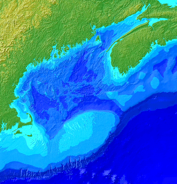
Detailed information regarding the construction of this digital bathymetry image may be found at the Gulf of Maine Information System project page located at the Woods Hole Field Center. Image created by Rich Signell.

Close Window


skip index

OFR03-001 Home | Introduction | Nomenclature | Browse Maps | Data Catalog | Data Dictionary

[an error occurred while processing this directive]