U.S. Geological Survey Open-File Report 03-001
| PREVIOUS | NEXT | |
|
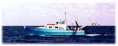
Photo shows a port-side view of the A E VERRILL at sea. This 20-m steel hulled vessel was used for coastal work during the joint USGS/WHOI Continental margin Program. |
||
 |
||
| PREVIOUS | Close Window | NEXT |