Skip past header information
USGS Logo with Link to USGS Home Page
High-resolution seismic-reflection surveys in the nearshore of outer Cape Cod, Massachusetts, USGS Open-File Report 03-235

Back to Title Page

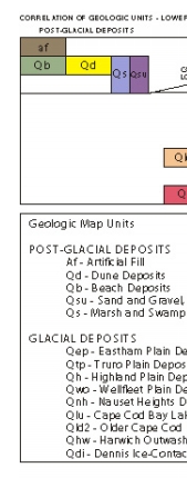
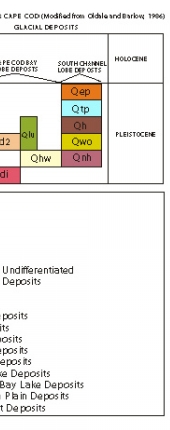
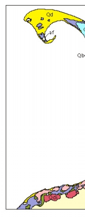
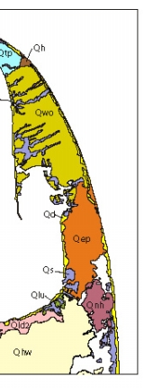
Figure 3. Surficial geologic map and correlation of geologic units of Lower Cape Cod (from Oldale and Barlow, 1986). See figure 4 for place names and town boundaries.

Click on figure for larger image (PDF format 116 KB).

Figure 3. Surficial geologic map and correlation of geologic units of Lower Cape Cod. Figure 3. Surficial geologic map and correlation of geologic units of Lower Cape Cod. Figure 3. Surficial geologic map and correlation of geologic units of Lower Cape Cod. Figure 3. Surficial geologic map and correlation of geologic units of Lower Cape Cod.


Adobe Acrobat Reader To view files in PDF format, download free copy of Adobe Acrobat Reader.


Skip Footer Information
Department of Interior
 /  U.S. Geological Survey  /  Coastal and Marine Geology / 

U.S.G.S. Privacy Statement  /  Disclaimer  /  Accessibility
This is http://pubs.usgs.gov/pubs/of/2003/of03-235/html/fig3.html
Maintained by Eastern Publications Group
Modified Saturday, 12-Jan-2013 23:24:56 EST