Skip past header information
USGS Logo with Link to USGS Home Page
High-resolution seismic-reflection surveys in the nearshore of outer Cape Cod, Massachusetts, USGS Open-File Report 03-235

Back to Title Page

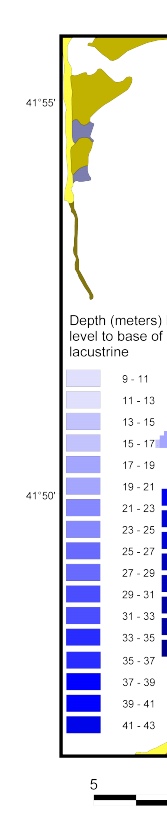
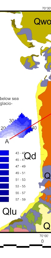
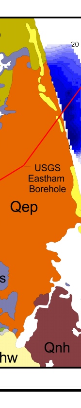
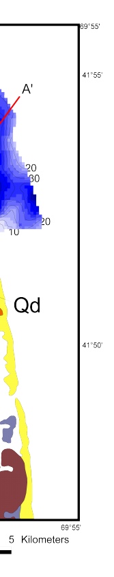
Figure 9. Map showing the depth (meters) to the base of glaciolacustrine (Qdl). Location of cross section A (Fig. 13) shown with red line. Surficial geologic units are described in figure 3.

Click on figure for larger image (PDF format 173 KB).

Figure 9. Map showing the depth (meters) to the base of glaciolacustrine. Figure 9. Map showing the depth (meters) to the base of glaciolacustrine. Figure 9. Map showing the depth (meters) to the base of glaciolacustrine. Figure 9. Map showing the depth (meters) to the base of glaciolacustrine.

Adobe Acrobat Reader To view files in PDF format, download free copy of Adobe Acrobat Reader.


Skip Footer Information
Department of Interior
 /  U.S. Geological Survey  /  Coastal and Marine Geology / 

U.S.G.S. Privacy Statement  /  Disclaimer  /  Accessibility
This is http://pubs.usgs.gov/pubs/of/2003/of03-235/html/fig9.html
Maintained by Eastern Publications Group
Modified Saturday, 12-Jan-2013 23:25:01 EST