|
|
|
|
|
|
|
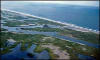
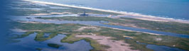
Role of Human Activities: Coastal Excavation
Deep-draft navigation channels are often constructed from artificial inlets or converted from tidal inlets and rivers. Regardless of their origin they always create large sediment sinks that remove some beach-quality sand from the littoral system. Newly created channels intercept currents and redirect flow altering the hydrodynamics of coastal water bodies and sediment dispersal patterns. In turn these modifications can initiate or accelerate land loss by locally enhancing erosive forces, increasing water levels, and decreasing sediment supply. Long jetties protecting the channels can compartmentalize the coast disrupting the flow of littoral drift and preventing the exchange of sand between adjacent coastal compartments. Historically the sediment dredged from navigation channels has been placed in spoil disposal sites located either on land or in relatively deep water on the continental shelf. The dredged material normally contains at least some beach-quality sand or it may be entirely suitable for beach replenishment. Along the California coast, sand dredged from some harbors is returned to the beach, otherwise removal of beach sand from the littoral system by navigation projects constitutes a net loss to the sediment budget. Morton (1979) estimated that since their construction, impermeable jetties of the Texas coast trapped more than 50% of the sand liberated by updrift erosion. Clark (1991) also reported that sand losses at inlets were largely responsible for beach erosion in Florida. Some minor land losses are directly associated with mining and other resource extraction activities. Resource extraction includes mining beaches and barriers for heavy minerals and construction aggregate (sand and gravel), mining peat for horticultural uses, and dredging reefs and bay-margin deposits for shell that is used as road material or to manufacture cement. These extraction activities may also indirectly cause additional land losses by changing water circulation patterns, decreasing sediment supply, and increasing water depths. For example, mining large volumes of shell from bays and estuaries removes natural breakwaters, such as reefs and marine grass flats, and increases wave energy along some shoreline segments. Even mining sand on the inner continental shelf for beach restoration can cause additional land losses by altering wave refraction patterns and concentrating wave energy on the beach as a result of the depression created. Beach erosion has accelerated at several sites as a result of beach replenishment projects that dredged sand from the nearby continental shelf. At Grand Isle, Louisiana, beach erosion increased and the shore became highly irregular after a borrow pit was dug about 1 km offshore to replenish the beach (Combe and Soileau, 1987). A large hole 3 to 6 m deep was left on the floor of the Gulf of Mexico after more than 5,000,000 cubic meters of sediment were dredged for the beach fill. The hole altered the paths of incoming waves and locally focused some of the wave energy causing the accelerated erosion. |