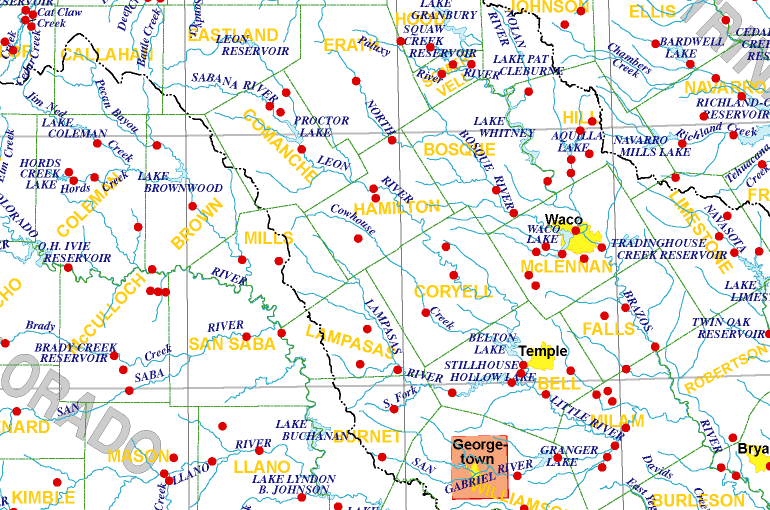
RETURN TO MAIN STATE MAP  
Substantial Flood Peaks in Texas

Peak streamflow and gage height for each station can be viewed by clicking on a red dot on the map or station name in the text links below the map. The elevation for each annual peak can be obtained by adding the peak gage height to the elevation for the gage datum above sea level.

Up-to-date files of annual-peak data also can be obtained on the internet at http://waterdata.usgs.gov/tx/nwis/peak

SMALL MAP (for 640 x 480 screen size resolution)
MEDIUM MAP (for 800 x 600 screen size resolution)
LARGE MAP (for larger screen size resolution)

TEXT LINKS OF STATIONS

GEORGETOWN INSET MAP
Streamflow-gaging stations in Map Section 7

Trinity River Basin
USGS Station 08049580 – Mountain Creek near Venus
USGS Station 08062500 – Trinity River near Rosser
USGS Station 08062900 – Kings Creek near Kaufman
USGS Station 08063100 – Richland Creek near Dawson
USGS Station 08063180 – Briar Creek Tributary near Corsicana
USGS Station 08063200 – Pin Oak Creek near Hubbard
USGS Station 08063500 – Richland Creek near Richland
USGS Station 08063550 – Alvarado Branch near Alvarado
USGS Station 08063620 – Kings Branch near Reagor Springs
USGS Station 08063800 – Waxahachie Creek near Bardwell
USGS Station 08064100 – Chambers Creek near Rice
USGS Station 08064500 – Chambers Creek near Corsicana
USGS Station 08064700 – Tehuacana Creek near Streetman

Brazos River Basin
USGS Station 08083245 – Mulberry Creek near Hawley
USGS Station 08083300 – Elm Creek near Abilene
USGS Station 08083400 – Little Elm Creek near Abilene
USGS Station 08083420 – Cat Claw Creek at Abilene
USGS Station 08083430 – Elm Creek at Abilene
USGS Station 08083470 – Cedar Creek at Abilene
USGS Station 08083480 – Cedar Creek at IH 20, Abilene
USGS Station 08086050 – Deep Creek at Moran
USGS Station 08086235 – Battle Creek near Moran
USGS Station 08091000 – Brazos River near Glen Rose
USGS Station 08091200 – Morris Branch near Bluff Dale
USGS Station 08091500 – Paluxy River at Glen Rose
USGS Station 08091700 – Panter Branch near Tolar
USGS Station 08091750 – Squaw Creek near Glen Rose
USGS Station 08092000 – Nolan River at Blum
USGS Station 08093100 – Brazos River near Aquilla
USGS Station 08093200 – Bond Branch near Hillsboro
USGS Station 08093250 – Hackberry Creek at Hillsboro
USGS Station 08093360 – Aquilla Creek above Aquilla
USGS Station 08093400 – Cobb Creek near Abbott
USGS Station 08093500 – Aquilla Creek near Aquilla
USGS Station 08093700 – N Bosque River at Stephenville
USGS Station 08094800 – N Bosque River at Hico
USGS Station 08095000 – N Bosque River near Clifton
USGS Station 08095200 – N Bosque River at Valley Mills
USGS Station 08095220 – S Bosque River near McGregor
USGS Station 08095250 – Willow Branch at McGregor
USGS Station 08095300 – Middle Bosque River near McGregor
USGS Station 08095400 – Hog Creek near Crawford
USGS Station 08095500 – S Bosque River near Speegleville
USGS Station 08095600 – Bosque River near Waco
USGS Station 08096500 – Brazos River at Waco
USGS Station 08096550 – Box Branch at Robinson
USGS Station 08097500 – Brazos River near Marlin
USGS Station 08098000 – Deer Creek at Chilton
USGS Station 08098290 – Brazos River near Highbank
USGS Station 08098300 – Little Pond Creek near Burlington
USGS Station 08099100 – Leon River near De Leon
USGS Station 08099300 – Sabana River near De Leon
USGS Station 08099350 – Sabana River Tributary near De Leon
USGS Station 08099500 – Leon River near Hasse
USGS Station 08100000 – Leon River near Hamilton
USGS Station 08100100 – Edison Creek near Hamilton
USGS Station 08100400 – Bermuda Branch near Gatesville
USGS Station 08100500 – Leon River at Gatesville
USGS Station 08100800 – Hoffman Branch near Hamilton
USGS Station 08101000 – Cowhouse Creek at Pidcoke
USGS Station 08102500 – Leon River near Belton


Brazos River Basin (continued)
USGS Station 08102600 – Nolan Creek at Belton
USGS Station 08102900 – School Branch near Lampasas
USGS Station 08103450 – Fleece Branch near Lampasas
USGS Station 08103800 – Lampasas River near Kempner
USGS Station 08103900 – South Fork Rocky Creek near Briggs
USGS Station 08104000 – Lampasas River at Youngsport
USGS Station 08104100 – Lampasas River near Belton
USGS Station 08104500 – Little River near Little River
USGS Station 08104850 – S Fork San Gabriel River near Bertran
USGS Station 08105400 – San Gabriel River near Circleville
USGS Station 08105700 – San Gabriel River at Laneport
USGS Station 08105900 – Avery Branch near Taylor
USGS Station 08106300 – Brushy Creek near Rockdale
USGS Station 08106310 – San Gabriel River near Rockdale
USGS Station 08106350 – Little River near Rockdale
USGS Station 08106500 – Little River at Cameron
USGS Station 08107000 – Big Elm Creek near Temple
USGS Station 08107500 – Big Elm Creek near Buckholts
USGS Station 08108000 – N Elm Creek near Ben Arnold
USGS Station 08108200 – N Elm Creek near Cameron
USGS Station 08108700 – Brazos River at SH 21 near Bryan
USGS Station 08108800 – Little Branch near Bryan
USGS Station 08109000 – Brazos River near Bryan
USGS Station 08110325 – Navasota River above Groesbeck
USGS Station 08110350 – Plummers Creek at Mexia
USGS Station 08110400 – Navasota River near Groesbeck
USGS Station 08110430 – Big Creek near Freestone
USGS Station 08110500 – Navasota River near Easterly
USGS Station 08111025 – Burton Creek at Villa Maria Rd at Bryan

Colorado River Basin
USGS Station 08136700 – Colorado River near Stacy
USGS Station 08136900 – Mukewater Creek SWS No. 10-A near Trickham
USGS Station 08138000 – Colorado River at Winchell
USGS Station 08139500 – Deep Creek near Mercury
USGS Station 08140000 – Deep Creek SWS No. 6 near Mercury
USGS Station 08140500 – Dry Prong Deep Creek near Mercury
USGS Station 08140700 – Pecan Bayou near Cross Cut
USGS Station 08140800 – Jim Ned Creek near Coleman
USGS Station 08141100 – McCall Branch near Coleman
USGS Station 08141500 – Hords Creek near Valera
USGS Station 08142000 – Hords Creek near Coleman
USGS Station 08143500 – Pecan Bayou at Brownwood
USGS Station 08143600 – Pecan Bayou near Mullin
USGS Station 08143700 – Browns Creek Tributary near Goldthwaite
USGS Station 08144500 – San Saba River at Menard
USGS Station 08144600 – San Saba River near Brady
USGS Station 08144800 – Brady Creek near Eden
USGS Station 08145000 – Brady Creek at Brady
USGS Station 08145100 – Brady Creek Tributary near Brady
USGS Station 08146000 – San Saba River at San Saba
USGS Station 08147000 – Colorado River near San Saba
USGS Station 08148500 – N Llano River near Junction
USGS Station 08150200 – Llano River Tributary near London
USGS Station 08150700 – Llano River near Mason
USGS Station 08150800 – Beaver Creek near Mason
USGS Station 08150900 – Stone Creek Tributary near Art
USGS Station 08151000 – Llano River near Castell
USGS Station 08151300 – Johnson Creek near Valley
USGS Station 08151500 – Llano River at Llano
USGS Station 08152000 – Sandy Creek near Kingsland
USGS Station 08152700 – Little Flatrock Creek near Marble Falls


RETURN TO TOP OF PAGE