|
|
|
|
|
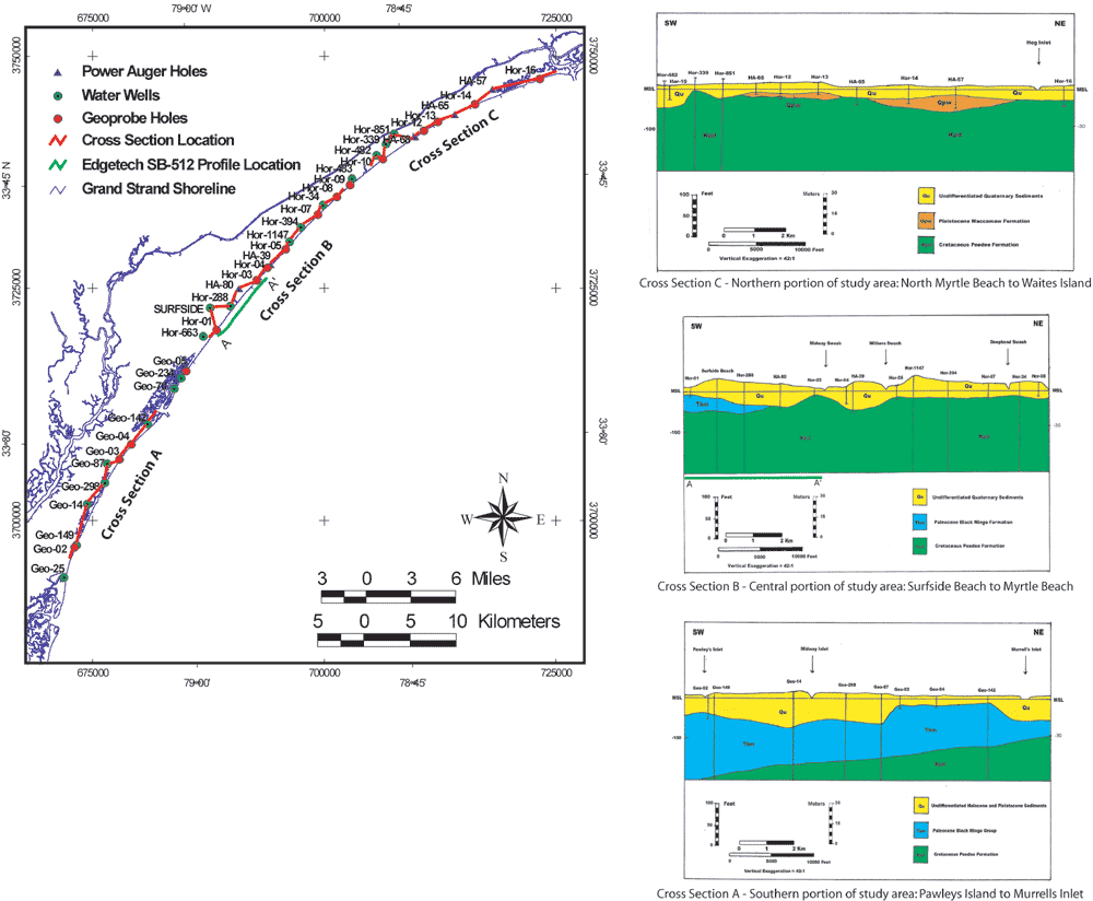
Figure 8. Three shore-parallel cross sections, generated by Putney and others (2002), incorporating drilling data from Geoprobe, water wells and power auger. Location figure (left) shows position for each of the sections. Boring data from the beach transects indicate approximately 10 - 30 m of Quaternary (Holocene and Pleistocene) sediment overlying older Cretaceous and Tertiary continental shelf deposits. The boundary between underlying Cretaceous/Tertiary units is identified within the central and southern cross sections, and is shown to shallow significantly in the Surfside Beach area, between Geoprobe holes Hor-1 and Hor-3. The position of the nearshore Edgetech SB-512 CHIRP sub-bottom profile A - A' (Figure 9) is also indicated on the location figure (left) (modified from Putney and others, 2002).
|
Can't see the printable PDF version? Get the free Adobe Acrobat® Reader. |