Surficial Geology and Analysis of post-impoundment sediment of Lake Mohave
Open-File Report 2004-1256
|
Title Page / Introduction / Methods / Results / Discussion / Conclusion / Acknowledgments / References |
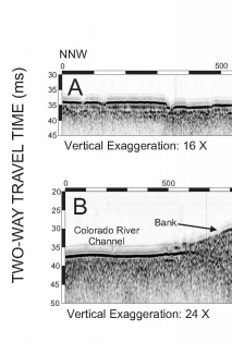
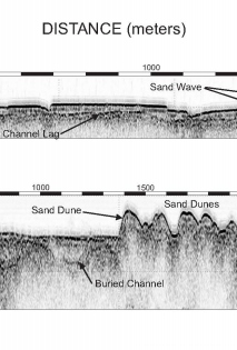
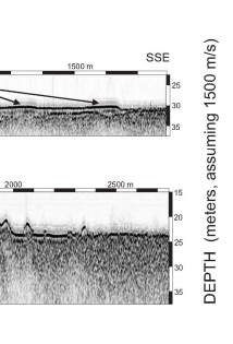
Figure 11. Chirp profile images showing large sand waves from the pre-impoundment Colorado River channel (A) and pre-impoundment subaerial sand dunes (B). See figure 5 for profile locations. Depth is depth from lake level at the time of the survey assuming a sound velocity of 1500 m/s.
Click for larger image (PDF version, 409 KB).
 |  |  |
![]() To view files in PDF format, download free copy of Adobe Reader.
To view files in PDF format, download free copy of Adobe Reader.
