Surficial Geology and Analysis of post-impoundment sediment of Lake Mohave
Open-File Report 2004-1256
|
Title Page / Introduction / Methods / Results / Discussion / Conclusion / Acknowledgments / References |
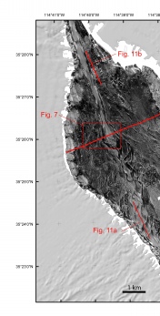
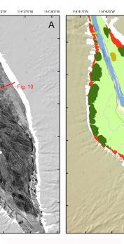
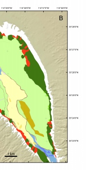
Figure 5. Sidescan sonar mosaic (A) and interpretation (B) of the surficial geology of the southern central part of Lake Mohave. See figure 3 for explanation of surficial units. Locations of Chirp profiles (fig. 10, figs. 11a,11b) are shown with red lines on the sidescan mosaic.
Click for larger image (PDF version, 2.9 MB).
 |  |  |
![]() To view files in PDF format, download free copy of Adobe Reader.
To view files in PDF format, download free copy of Adobe Reader.
