Surficial Geology and Analysis of post-impoundment sediment of Lake Mohave
Open-File Report 2004-1256
|
Title Page / Introduction / Methods / Results / Discussion / Conclusion / Acknowledgments / References |
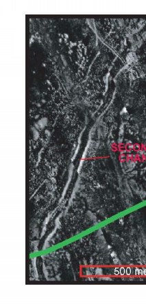
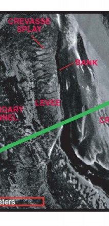
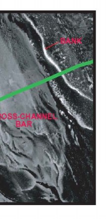
Figure 7. Detailed sidescan sonar mosaic (location shown in fig. 5a) showing pre-impoundment fluvial features preserved on the lake floor. The green line indicates the location of the Chirp profile shown in figure 10.
Click for larger image (PDF version, 1.5 MB).
 |
 |
 |
![]() To view files in PDF format, download free copy of Adobe Reader.
To view files in PDF format, download free copy of Adobe Reader.
