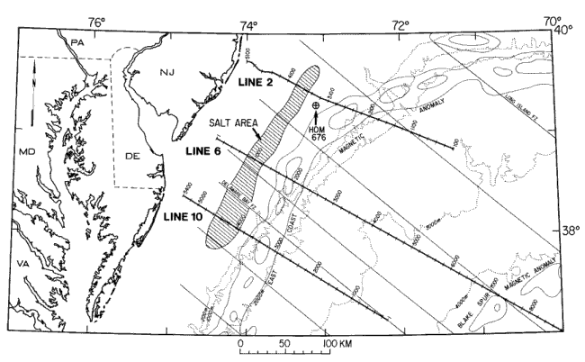
Figure 1. The Baltimore Canyon Trough is between the Carolina Trough to the south and Georges Bank Basin to the northeast. Bathymetry is denoted by dotted lines. Fracture zones (FZ) in medium solid lines, and the East Coast and Blake Spur magnetic anomalies by light lines, are from Klitgord and others (1988). Multichannel seismic lines, with CMP (common mid-point) numbers annotated, are shown by the heavy lines. Approximate area of salt lens is shown by the hatchured area. HOM 676, on the seaward flank of the Schlee Dome, is the location of the well that penetrated salt.
|