|
||||
| U.S. Geological Survey Open-File Report 2004-1435 |

Early to Middle Jurassic Salt in Baltimore Canyon Trough
|
|
|
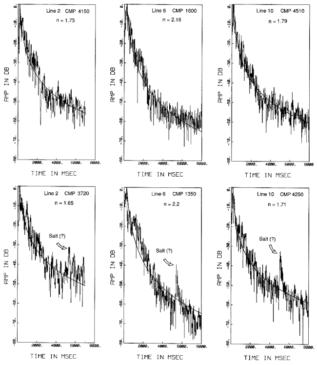
Figure 4. Plots of amplitude decrease with time for the three multichannel seismic lines. The plots are shown for two CMP's in each line -- one in the salt lens area and, for comparison, one away from the salt. Curves shown are the least-squares best fit of the amplitude into a power law (t**n, where t=two-way traveltime).
| ||||

| ||||