
![]()
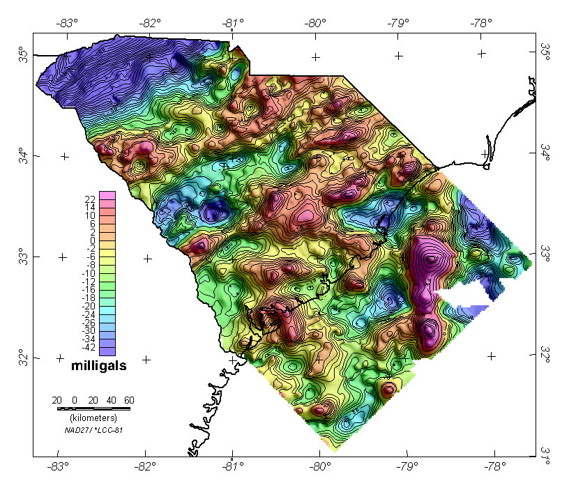
South Carolina Complete Bouguer Gravity Anomaly Map
![]()
Complete Bouguer gravity anomaly map of South Carolina and adjacent offshore area. Illumination is from the northeast. Click on map to view larger image (1.7 MB).
Map of gravity stations used to produce the grid for the contour map.
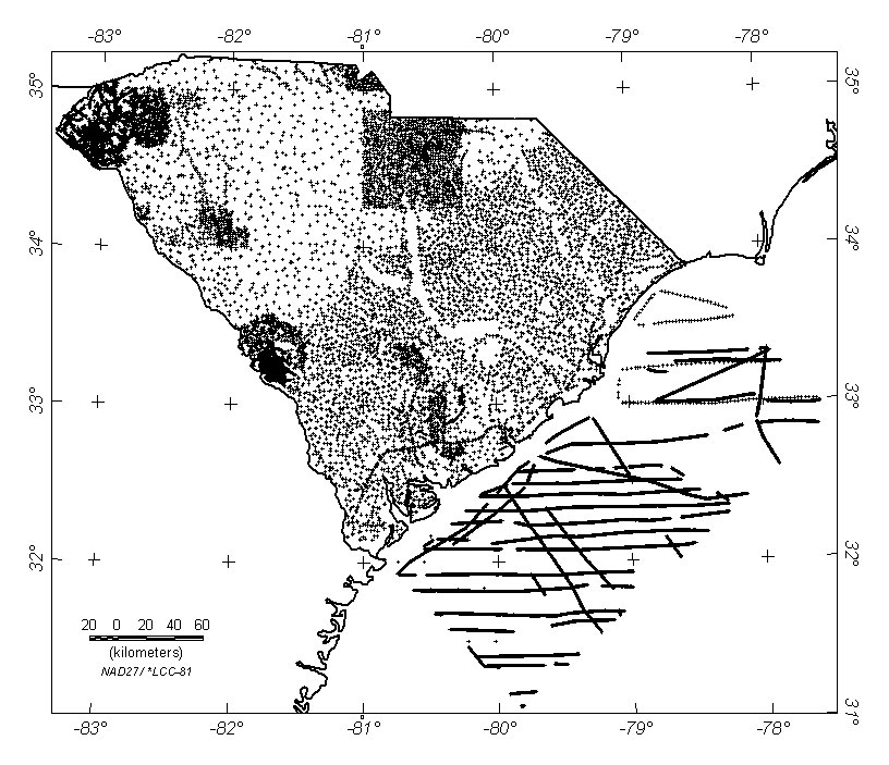
The complete Bouguer gravity anomaly grid used to make the above contour map was compiled using data from 25,584 gravity measurements: 11,826 gravity stations on land and 13,758 measurements offshore. Marine shipboard measurements extend to a distance of about 140 km (87 mi.) offshore. These data were extracted from the Gravity 1991 and 1999 CD-ROM editions issued by the National Geophysical Data Center (NGDC) (NGDC, 1991; Dater and others, 1999). The data come from 39 separate surveys but many of the surveys are not identified in the NGDC discs. All of the offshore data are from survey #76. Observed gravity are relative to the IGSN-71 datum were reduced to the Bouguer anomaly using the 1967 gravity formula and a reduction density of 2.67 g/cc. The offshore points are free air anomaly. Terrain and Earth curvature corrections (based on software by Plouff, 1977) are included for Hammer zones F-O (0.895 to 167 km outward from the station). The station data were converted to a 2-km grid using minimum curvature techniques.
The gravity data are available as ASCII files for station data or as a grid (use the download data link below).
|| Top || Page 1 || Compilation || Processing || Mag Index Map || Download data || References ||
USGS Links: || USGS - Eastern Minerals Team || USGS - Geology Discipline || USGS - Home Page ||