Open-File Report 2005-1048
U.S. Geological Survey Open-File Report 2005-1048
Geological Interpretation of Bathymetric and Backscatter Imagery of the Sea Floor Off Eastern Cape Cod, Massachusetts
BOTTOM PHOTOGRAPHS
|
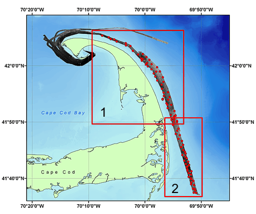
To select an area for closer viewing, please click within the selected map area. From the detailed map, you may view the bottom photo for any location by selecting the desired station identifier with your cursor.
|

![]() U.S. Department of the Interior |
U.S. Geological Survey
U.S. Department of the Interior |
U.S. Geological Survey
URL: http://pubsdata.usgs.gov/pubs/of/2005/1048/htmldocs/bphotos-indexmap.htm
Page Contact Information: GS Pubs Web Contact
Page Last Modified: Friday, 23-Aug-2024 13:10:58 EDT