|
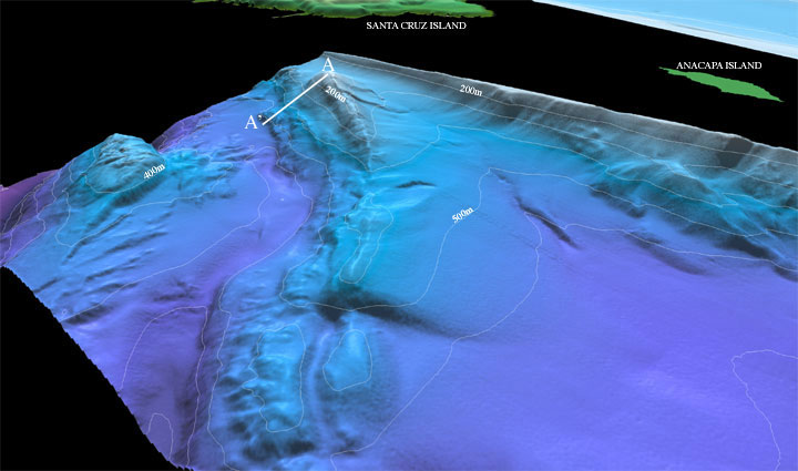
Figure 1: Perspective view of the Northeastern Channel Islands multibeam bathymetry looking northwest towards Santa Cruz and Anacapa Islands (arrow 1 on location map). This area is referred to as the Footprint area. The ridge in the center, trends northwest-southeast for a distance of 13 km in this image and rises approximately 450 m at A-A' . The distance across the bottom of the image is approximately 12 km. The vertical exaggeration is 2x.
Download 300dpi TIFF image (19 Mb)
|