![]()
![]()
|
|
|
| Multibeam Bathymetry and Backscatter Data: Northeastern Channel Islands Region, Southern California |
|
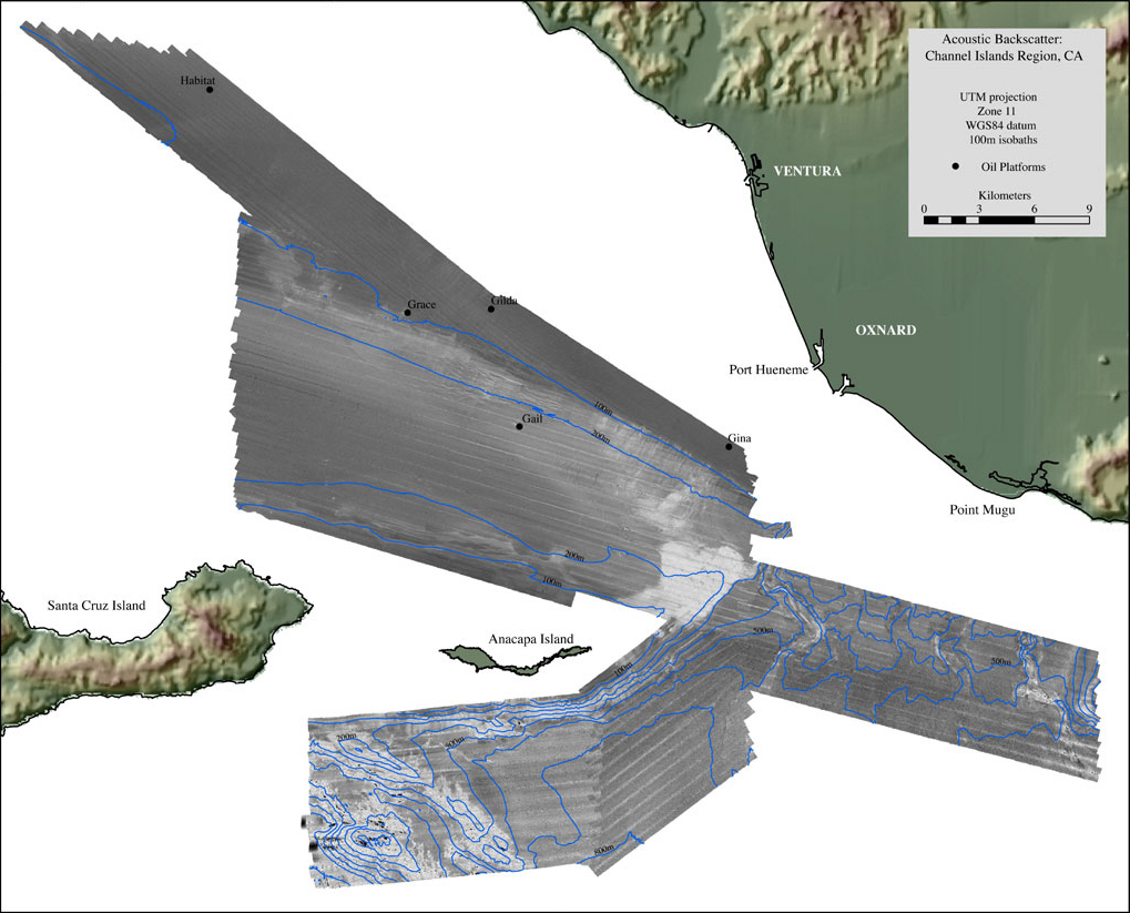
| Acoustic backscatter imagery generated from the 2004 multibeam sonar survey of the Northeastern Channel Islands region. Depths within the survey area range from 25 - 1246m. Lighter tones in this image represent higher backscatter while darker tones represent lower backscatter. Black dots and names denote the locations of oil-drilling platforms. |
|
|
|||||||
|
http://pubs.usgs.gov/of/2005/1153/mos.html maintained by Michael Diggles last modified April 6, 2005 (PD) |