|
|
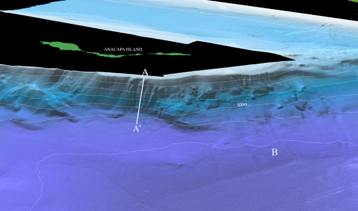
| Figure 2: Perspective view of the Northeastern Channel Islands multibeam bathymetry looking north towards Anacapa Island (arrow 2 on location map). The gullied slope south of Anacapa Island (A-A') rises steeply for approximately 520 m. Channels trending down slope (B) with widths from 100 - 200 m, incise into the slope between 2 - 6 m and terminate abruptly at the northern end of the Santa Monica Basin. The distance across the bottom of the image is approximately 9 km. The vertical exaggeration is 2X. Download 300dpi TIFF image (19 Mb)
|
|