|
|
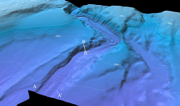
| Figure 3: Perspective view of the Northeastern Channel Islands multibeam bathymetry looking north over the Hueneme Canyon (arrow 3 on location map). The canyon thalweg increases in water depth from 465 m to 646 m in this image, while the width of the canyon at the bottom of the image at A-A' is about 800 m. The northern canyon wall at B-B' is approximately 100m high. The distance across the bottom of the image is approximately 6 km. The vertical exaggeration is 2X. Download 300dpi TIFF image (19 Mb)
|
|