|
|
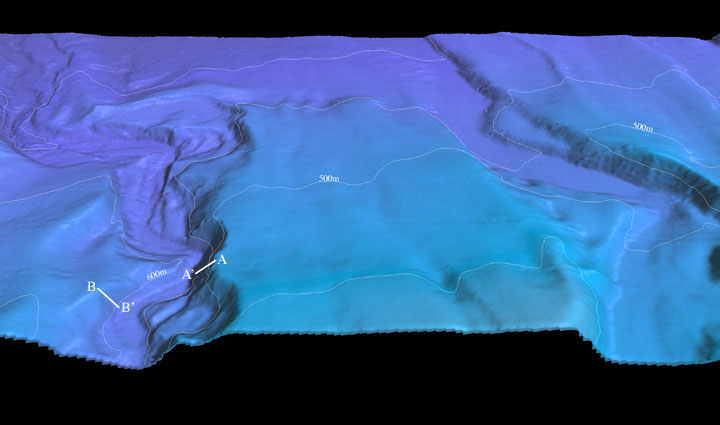
| Figure 4: Perspective view of the Northeastern Channel Islands multibeam bathymetry looking south down the Mugu Canyon on the left (west) (arrow 4 on location map). The canyon thalweg drops in water depth from 607 m to 767 m in this image. The northern canyon wall at A-A' is approximately 150m high, while the southern wall at B-B' is approximately 90 m high.The distance across the bottom of the image is approximately 5 km. The vertical exaggeration is 2X. Download 300dpi TIFF image (19 Mb)
|
|