|
|
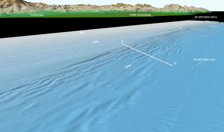
| Figure 5: Perspective view of the Northeastern Channel Islands multibeam bathymetry looking east towards Ventura and Port Hueneme (arrow 5 on location map). On the shelf under approximately 100m water depth, linear features trend parallel to the shelf break. On the slope, below 150m water depth, more deeply incised linear feature also trend parallel to the shelf break. Although these features vary in height and wave length, the bathymetric profile (below) down the slope at A-A' shows that the features directly inshore of Platform Gail are about 3-5m high and have wavelengths of about 200m. The linear features end abruptly toward the southeast where the slope is incised by gullies the extend downslope. The distance across the bottom of the image is approximately 4 km. The vertical exaggeration is 2X. |
Download 300dpi TIFF image (19 Mb)
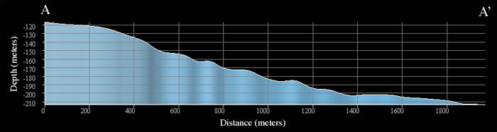
| Profile A-A': Bathymetric profile from A-A' in Figure 5 above. The profile trends down slope from a water depth of 115m to 210m over a distance of 1900m. The profile has approximately 4X vertical exaggeration. |
|