|
|
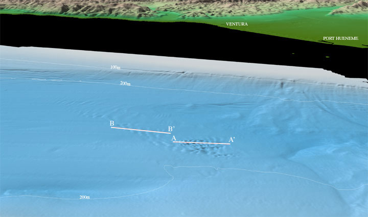
| Figure 6. Figure 1: Perspective view of the Northeastern Channel Islands multibeam bathymetry looking north towards the towns of Ventura and Port Hueneme at the eastern end of the Santa Barbara Channel (arrow 6 on location map). In the center of the channel under about 230 m water depth is a bedform field. The larger features at A-A' have wavelengths on the order of 50 - 125 m with heights of about 3 - 12 m (see profile A-A' below). In contrast, the features at B-B' are less high (1 - 4m), but they have longer wavelengths of 200 m (see profile B-B' below). The distance across the bottom of the image is approximately 12 km. The vertical exaggeration is 2X. Download 300dpi TIFF image (19 Mb)
|
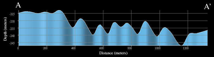
| Profile A-A' in figure 6 above. The profile crosses water depths from 224 - 246 m over a distance of about 1400 m. The profile has approximately 10X vertical exaggeration. |
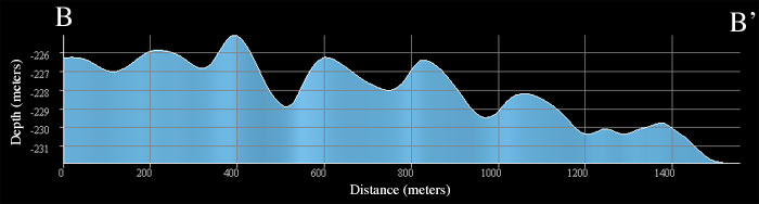
| Profile B-B' in figure 6 above. The profile crosses water depths from 224 - 232 m over a distance of about 1500 m. The profile has approximately 40X vertical exaggeration. |
|