|
|
|
|
|
| Report Home | Maps | Overview | Mapping Methods | Coastal Classifications | Geologic Setting | Coastal Processes | Coastal Vulnerability | Classification Summary | References | |||||||||||||||||||||||||||||||
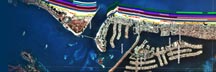
Geologic SettingThe Southeast Texas coast between Sabine Pass and the Colorado River consists of two headlands and modern barrier islands that flank the headlands. The eastern headland extends from Sabine Pass to the eastern end of Bolivar Peninsula and the western headland, which includes the modern Brazos River and Delta complex, extends from the western end of Follets Island to the eastern end of Matagorda Peninsula. The Gulf shoreline changes orientation around the western headland because this promontory is composed of deltaic sand and mud deposits, which were transported to the coast by the ancestral Brazos and Colorado Rivers. The beach sediments along both headlands typically contain broken shells and rock fragments as a result of long-term erosion and reworking of older coastal deposits exposed in the surf zone. Long-term erosion of the headlands acted as a source of some sediment for the adjacent barrier islands that include Bolivar Peninsula, Galveston Island, Follets Island, and Matagorda Peninsula (Morton, 1988). Barrier islands with numerous beach ridges, such as Bolivar Peninsula and Galveston Island, record abundant sand supply and seaward advancement of the Gulf shoreline when they formed several thousand years ago. |