Open-File Report 2005-1413
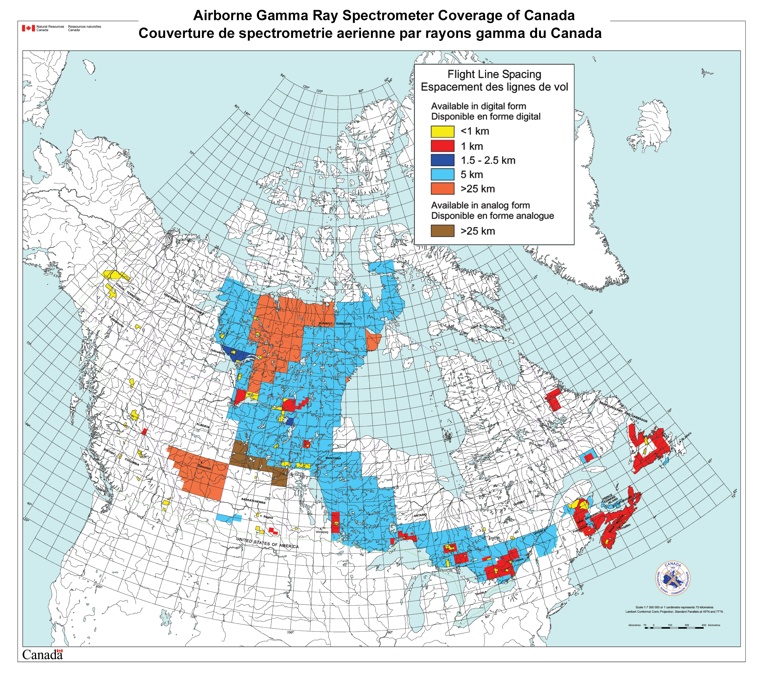
The image below shows the coverage of aerial gamma-ray surveys in Canada that were used for this compilation. Flightline spacings varied from less than 1 km to more than 25 km. A PDF file of this index map is also available. Please refer to the web site of the Geological Survey of Canada for current information about data in Canada. Click on the map to view a higher resolution version of the index map.
Home | Data Files | Data Processing | Flightline Databases | Maps | References | Glossary

![]() U.S. Department of the Interior |
U.S. Geological Survey
U.S. Department of the Interior |
U.S. Geological Survey
URL: http://pubsdata.usgs.gov/pubs/of/2005/1413/cansurveys.htm
Page Contact Information: USGS Publications Team
Page Last Modified: Saturday, 12-Jan-2013 21:48:40 EST
