Surficial sediment character of the New York-New Jersey offshore continental shelf region: A GIS Compilation
|
Images are black & White (e.g, Station 1418) Station List (Excel) Station List (*.txt) |
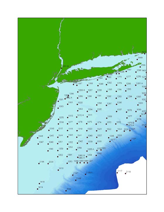
Sea-Floor PhotosThe New York and New Jersey region has been heavily studied by the US Geological survey, owing to its importance as one of the major recreational and industrial areas on the Atlantic seaboard. An abundance of reports on the geologic, geochemical and geophysical nature of this region are available, many of which are listed in the references section of this publication. Much of this data is complimentary, that is to say, individual datasets and reports can be used together to present a more complete and comprehensive overview of a given area. Sea-floor images are a good example of this, as good quality high-resolution photographs can aid in interpreting the geologic character of the sea floor and serve as ground truth data when used in conjunction with remotely sensed data such as sidescan sonar and multibeam hydrographic data. The interactive image below highlights a few of the available sea-floor photos from the New York-New Jersey region, and is provided as an example of additional data that may be obtained from the U.S. Geological Survey. These photographs are from Paskevich and others (2001) OFR 2001-154, and complete photos and metadata may be downloaded from the original report (a link is provided in the data catalog). Additional imagery beyond this region is available in Butman and others (2003), OFR 2001-470. To open the full jpeg images of these photographs, click the mouse over the individual stations shown in the image below. 
|
Main Menus
OFR 2006-1046 Home | Introduction | Nomenclature
| Sea-Floor Photos
| Data Dictionary |
Data Catalog | Browse Maps | References | Related Websites | Acknowledgments | Contacts | For Educators | Disclaimer | README
Sub-Menus
Seafloor Images |